Ranger Peak
| Site Name: | Ranger Peak | 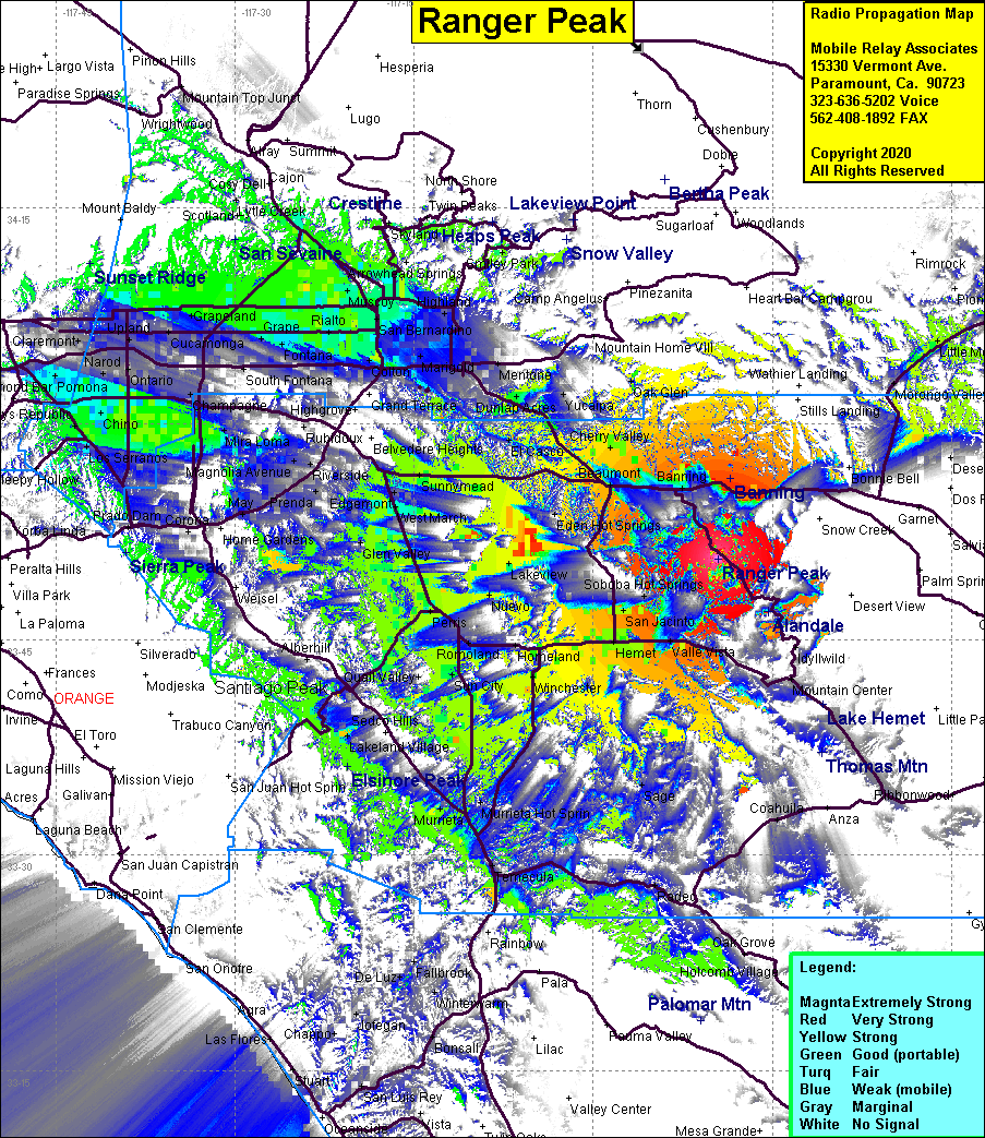 Ranger Peak Coverage |
| Latitude: | 033 50 36.7N | 33.8435278 |
| Longitude: | 116 49 30.7W | -116.8251944 |
| Feet | Meters | |
| Ground Elevation: | 5049.2 | 1539.0 |
| HAAT: | 1735.4 | 528.9 |
| City: | Pine Wood | |
| County: | Riverside | |
| State: | California |
This is not an MRA Owned Site. For space rental contact the site owner.
Do you own or manage this site? Click Here
Would you like to add a site to the Google Earth Map?? Click Here
Site Coverage: Pine Cove, San Jacinto, Hemet, Ramona Bowl, Banning, Cabazon, Beaumont, Nicklin, Calimesa, Winchester, Murieta, Perris, Lakeview Hot Springs, Lakeview, March Field, Sunnymead, Cherry Valley, Hinda
Amateur (ham) frequencies: