Rasor Road
| Site Name: | Rasor Road | 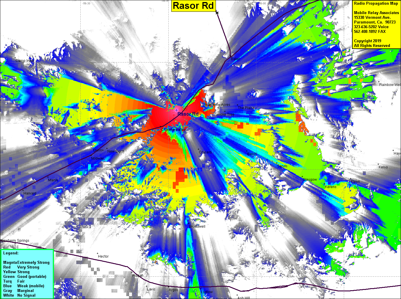 Rasor Road Coverage |
| Latitude: | 035 08 18.2N | 35.1383889 |
| Longitude: | 116 13 38.2W | -116.2272778 |
| Feet | Meters | |
| Ground Elevation: | 1,961.9 | 598.0 |
| HAAT: | 422.1 | 128.7 |
| City: | Baker | |
| County: | San Bernardino | |
| State: | California |
This is not an MRA Owned Site. For space rental contact the site owner.
Do you own or manage this site? Click Here
Would you like to add a site to the Google Earth Map?? Click Here
Site Coverage: Coverage of Interstate 15 from New Dunn to 5 miles southwest of Baker, Cronese Valley, Crucero, Smoke Tree
Amateur (ham) frequencies: