Rattlesnake Pass
| Site Name: | Rattlesnake Pass | 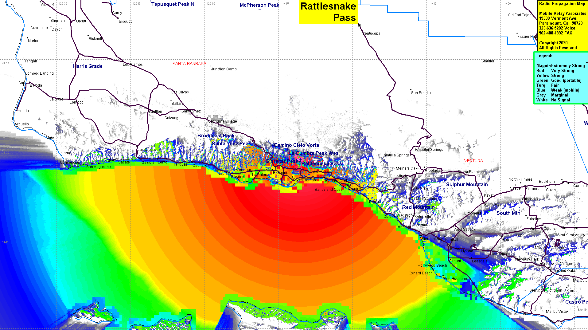 Rattlesnake Pass Coverage |
| Latitude: | 034 28 14.4N | 34.4706667 |
| Longitude: | 119 40 34.6W | -119.6762778 |
| Feet | Meters | |
| Ground Elevation: | 2454.1 | 748.0 |
| HAAT: | 1276.4 | 389.1 |
| City: | Santa Barbara | |
| County: | Santa Barbara | |
| State: | California |
This is not an MRA Owned Site. For space rental contact the site owner.
Do you own or manage this site? Click Here
Would you like to add a site to the Google Earth Map?? Click Here
Site Coverage: Santa Barbara, Hope Ranch, Goleta, La Padera, Ellwood, Naples, Coromar, El Sueno, Summerland, Montecito, Serena Peak, Shadyland Cove, Carpinteria, Punta, Punta Gorda, Sea Cliff, Dulah
Amateur (ham) frequencies: