Red Hill II
| Site Name: | Red Hill II | 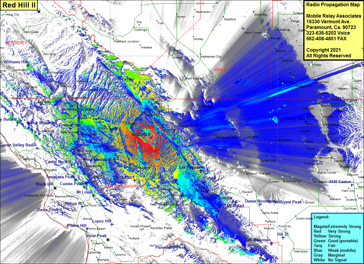 Red Hill II Coverage |
| Latitude: | 035 36 02.0N | 35.6005556 |
| Longitude: | 120 15 15.8W | -120.2543889 |
| Feet | Meters | |
| Ground Elevation: | 2592.0 | 790.0 |
| HAAT: | 982.4 | 299.4 |
| City: | Shandon | |
| County: | San Luis Obispo | |
| State: | California |
This is not an MRA Owned Site. For space rental contact the site owner.
Do you own or manage this site? Click Here
Would you like to add a site to the Google Earth Map?? Click Here
Site Coverage: Coverage of Garden Farms, Cushin, Henry, Atascadero, Creston, Linne, Templeton, Paso Robles, Capital Hill, Oak Park, Klau, Adelaida, Wellsona, Estrella, Old Adobe, San Miguel, McKay, Nacimiento, Bradley, Valleton, Parkfield, Whitley Gardens, Shandon, Cholame, Annette, Kecks Corner, Blackwell, Devils Den, Reef Station, Simmler, California Valley, Martinez Place, La Panza, Poza, Pippin Corner, Stratford, Helm Corner, Guernsey, Corcoran, Blanco, Angiola, Stoil, Allensworth, Krenell, Pond, Elmo, Neufeld, Wasco, Semitropic, Spicer City, Missouri Triangle, Lokern, Buttonwillow, Stevens, Rio Bravo, Crome, Hights Corner, Saco, Prospero, Cawelo, Slater, Thomas Lane, Myricks Corner, Palmo, Slater, Famoso, Calico, McFarland, Zentner, Vinland, Jasmin, Delano, Jovista, Quality, Trocha, RIchgrove, Vestal, Orris, Radnor, Earlimart, Pixley, Quail, Tipton, Octol, Tulare, Paige
Amateur (ham) frequencies: