Red Hill
| Site Name: | Red Hill | 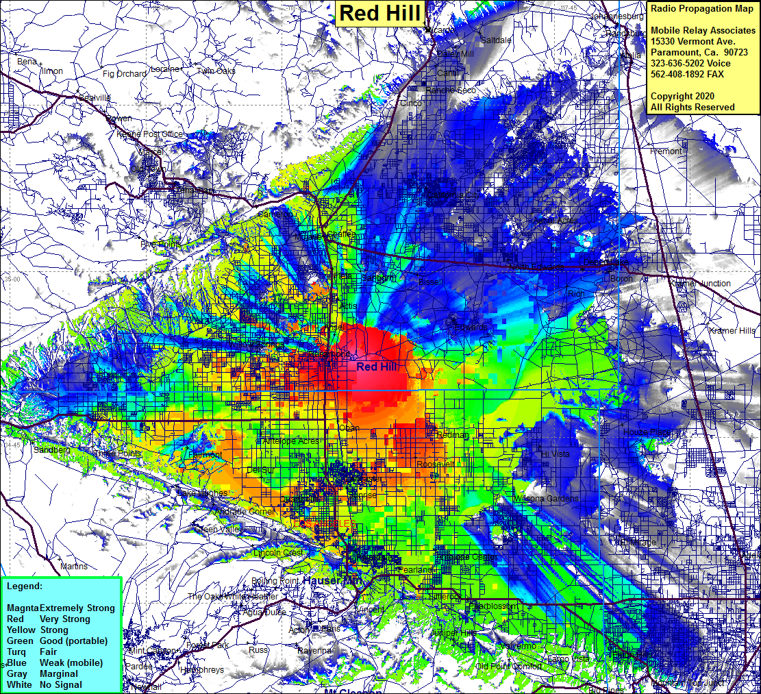 Red Hill Coverage |
| Latitude: | 034 52 09.5N | 34.8693056 |
| Longitude: | 118 07 05.8W | -118.1182778 |
| Feet | Meters | |
| Ground Elevation: | 2728.0 | 831.5 |
| HAAT: | 357.8 | 109.1 |
| City: | Mojave | |
| County: | Kern | |
| State: | California |
This is not an MRA Owned Site. For space rental contact the site owner.
Do you own or manage this site? Click Here
Would you like to add a site to the Google Earth Map?? Click Here
Site Coverage: Coverage of the high Desert, Rosamond, Actis, Fleta, Mojave, Chaffee, Sanborn, Bissell, Edwards, Rich, Boron, Desert Lake, Redman, Roosevelt, Lancaster, Sunrise, Quartz Hill, Del Sur, Antelope Acres, Willow Springs, Lancaster, Sunrise, Palmdale, Pearland, Antelope Center, Littlerock, Pearblossom, Wilsona Gardens, Hi Vista, El Mirage, California City, Aerial Acres, Cinco, Rancho Seco, Cantil, Gypsite, Cenada, Pinon Hills, El Mirage, Hi Vista, Houze Place
Amateur (ham) frequencies: