Reynolds Ridge
| Site Name: | Reynolds Ridge | 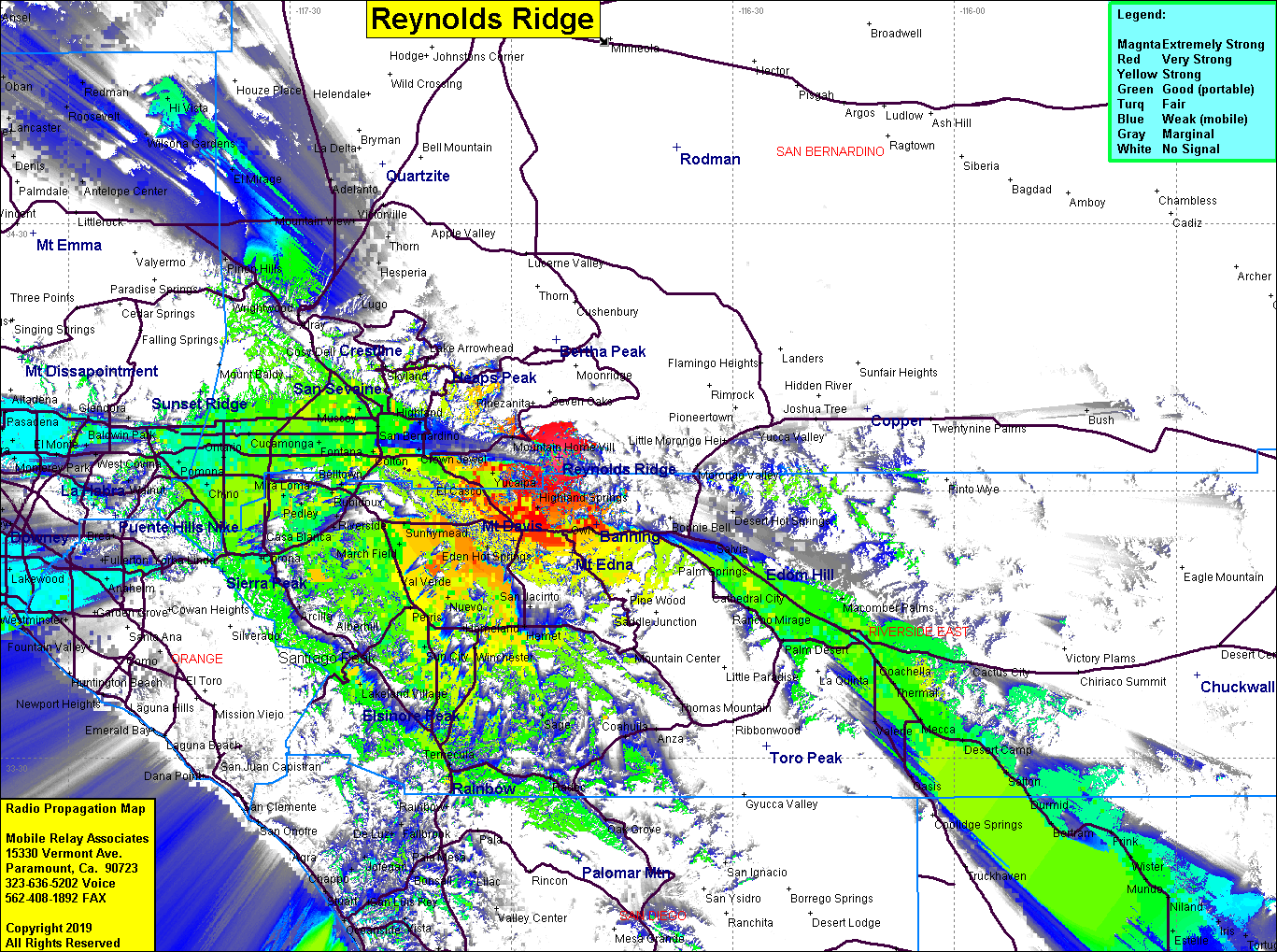 Reynolds Ridge Coverage |
| Latitude: | 034 03 45.6N | 34.0626667 |
| Longitude: | 116 53 36.6W | -116.8935000 |
| Feet | Meters | |
| Ground Elevation: | 9,056.0 | 2,760.3 |
| HAAT: | 3,520.7 | 1,073.1 |
| City: | Banning | |
| County: | San Bernardino | |
| State: | California |
This is not an MRA Owned Site. For space rental contact the site owner.
Do you own or manage this site? Click Here
Would you like to add a site to the Google Earth Map?? Click Here
Site Coverage: Coverage of the Inland Empire, Coachella Valley to the Salton Sea, Hesperia, northern San Gabriel Valley, parts of LA County
Amateur (ham) frequencies: