Rodman Mtn
| Site Name: | Rodman Mtn | 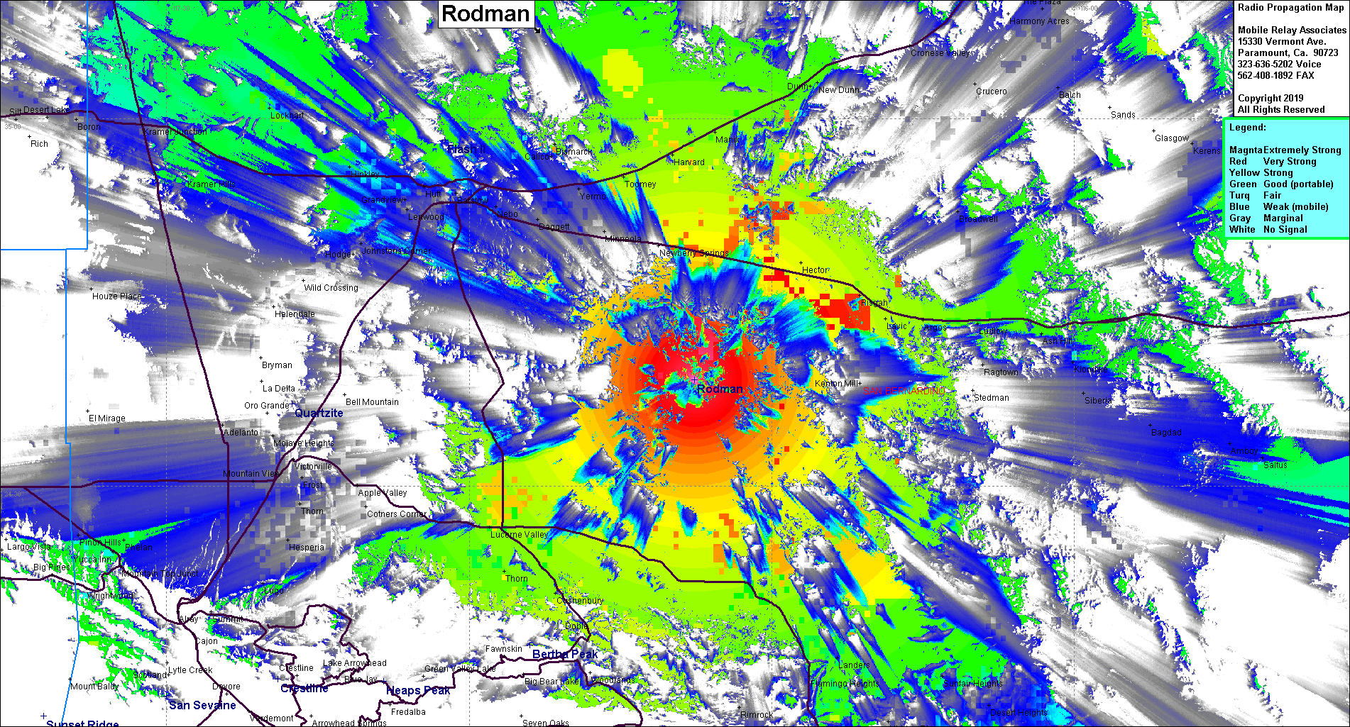 Rodman Mtn Coverage |
| Latitude: | 034 38 39.0N | 34.6441667 |
| Longitude: | 116 37 38.0W | -116.6272222 |
| Feet | Meters | |
| Ground Elevation: | 5,954.7 | 1,815.0 |
| HAAT: | 2,318.8 | 706.8 |
| City: | Newberry Springs | |
| County: | San Bernardino | |
| State: | California |
This is not an MRA Owned Site. For space rental contact the site owner.
Do you own or manage this site? Click Here
Would you like to add a site to the Google Earth Map?? Click Here
Site Coverage: Coverage of Interstate 40 from Newberry Springs to east of Ash Hill, Interstate 15 from Yermo to Afton Road, Lucerne Valley, Landers
Amateur (ham) frequencies: