Round Mtn
| Site Name: | Round Mtn | 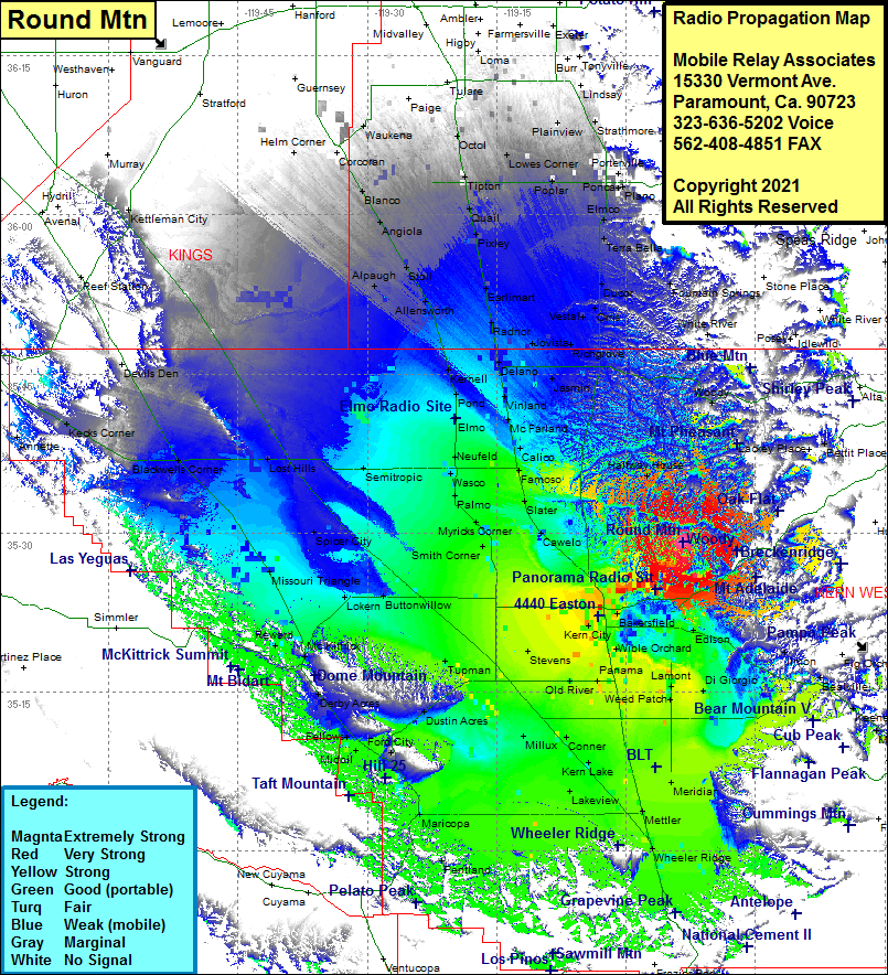 Round Mtn Coverage |
| Latitude: | 035 29 08.2N | 35.4856111 |
| Longitude: | 118 53 22.1W | -118.8894722 |
| Feet | Meters | |
| Ground Elevation: | 1616.0 | 492.6 |
| HAAT: | 502.1 | 153.0 |
| City: | Oildale | |
| County: | Kern | |
| State: | California |
This is not an MRA Owned Site. For space rental contact the site owner.
Do you own or manage this site? Click Here
Would you like to add a site to the Google Earth Map?? Click Here
Site Coverage: Coverage of Oil City, Bakersfield, Magunden, Edison, Lonsmith, Kayandee, Bena, Ilmon, Fuller Acres, Harpertown, Wible Orchard, Venola, Gosford, Kern City, Fruitvale, Greenacres, Rosedale, Stevens, Bealville, Meridian, Mettler, Wheeler Ridge, Lakeview, Maricopa, Spellacy, Ford City, Fellows, Valley Acres, Dustin Acres, Tupman, Reward, Missouri Triangle, Blackwells Corner, Lost Hills, Spicer City, Lokern, Buttonwillow, Rio Bravo, Semitropic, Hights Corner, Smith Corner, Myricks Corner, Palmo, Wasco, Lardo, Slater, Famoso, Calico, McFarland, Vinland, Delano, Palmo, Wasco, Newfeld, Elmo, Pond, Kernell, Kecks Corner, Annette, Helm Corner, Corcoran, Blanco, Angola, Stoil, Alpaugh, Allensworth, Radnor, Earlimart, Pixley, Quail, Tipton, Octol, Lowes Corner, Plainview, Sierra Heights, Strathmore, Zante, Poplar, Ponca, Magnolia, Elmco, Terra Bella, Ducor, Orris, Vestal, Trocha, Richgrove, Jasmin, Woody, Halfway House
Amateur (ham) frequencies: