San Augustine WT
| Site Name: | San Augustine WT | 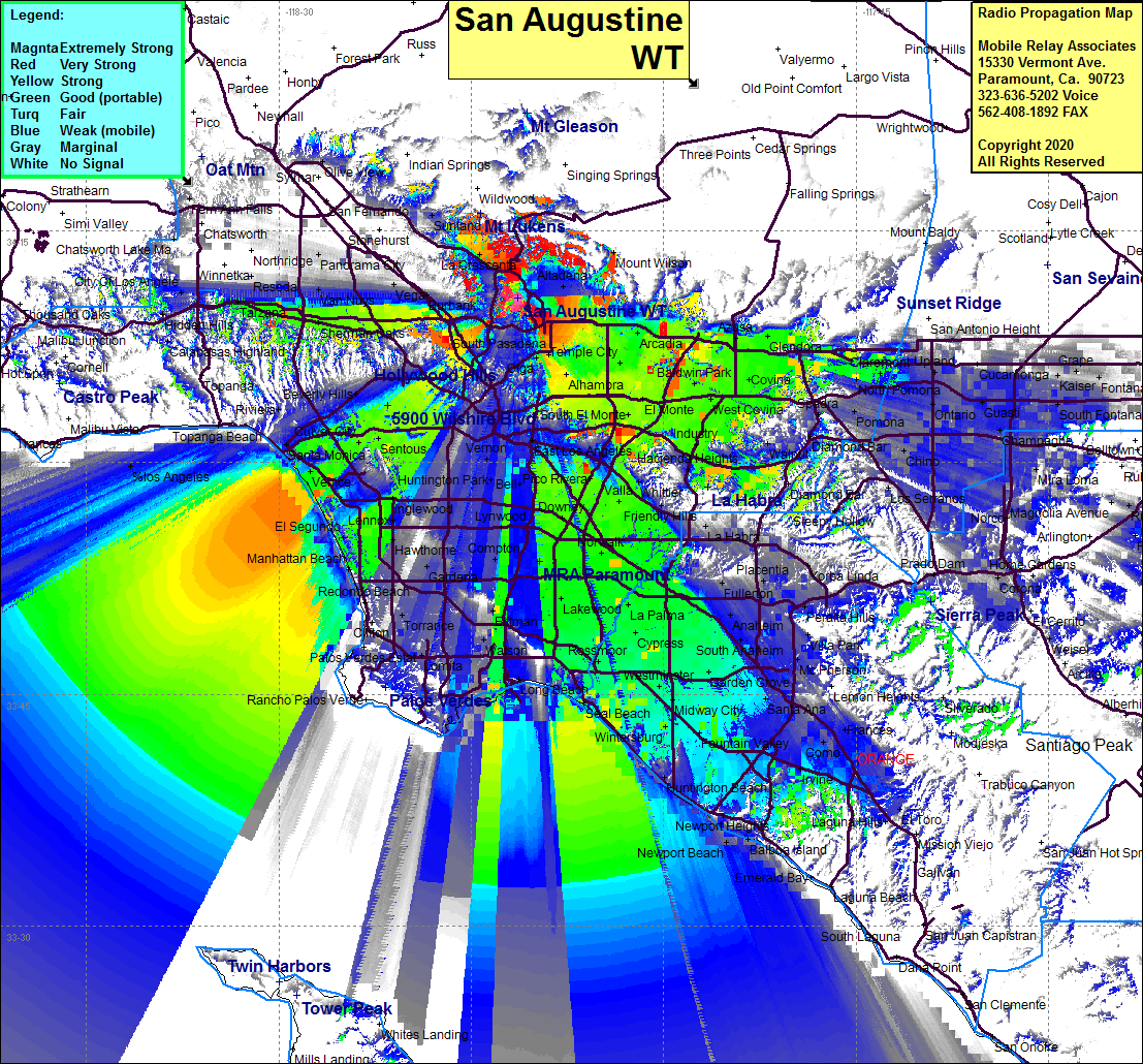 San Augustine WT Coverage |
| Latitude: | 034 10 40.3N | 34.1778611 |
| Longitude: | 118 11 20.6W | -118.1890556 |
| Feet | Meters | |
| Ground Elevation: | 1624.0 | 495.0 |
| HAAT: | 234.4 | 71.5 |
| City: | Glendale | |
| County: | Los Angeles | |
| State: | California |
This is not an MRA Owned Site. For space rental contact the site owner.
Do you own or manage this site? Click Here
Would you like to add a site to the Google Earth Map?? Click Here
Site Coverage: Coverage of the LA Basin, southern San Fernando Valley, San Gabriel Valley, Linda Vista, La Canada, La Crescenta, Eagle Rock, Glendale, Pasadena, San Dimas, Hacienda Heights, Glendora, Azusa, Temple City, El Monte, Alhambra, Monterey Park, Industry, Santa Fe Springs, Lakewood, Cypress, Stanton, Los Altos
Amateur (ham) frequencies: