San Onofre Tower
| Site Name: | San Onofre Tower | 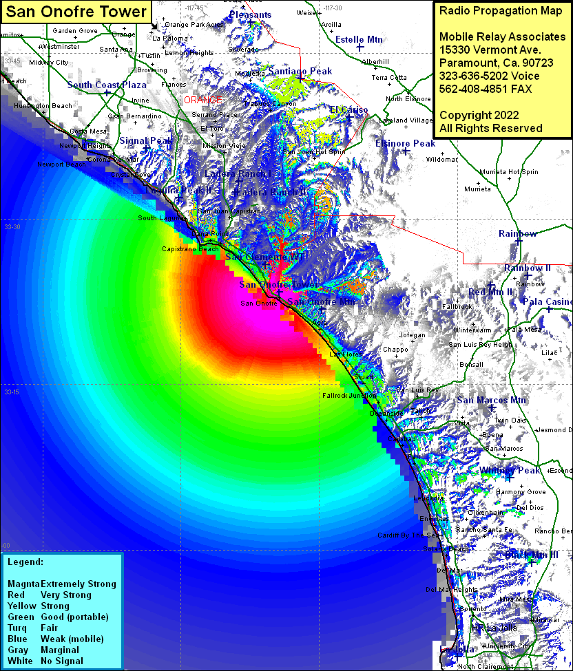 San Onofre Tower Coverage |
| Latitude: | 033 23 21.9N | 33.3894167 |
| Longitude: | 117 34 23.3W | -117.5731389 |
| Feet | Meters | |
| Ground Elevation: | 297.0 | 90.5 |
| HAAT: | 78.0 | 23.8 |
| City: | San Onofre | |
| County: | San Diego | |
| State: | California |
This is not an MRA Owned Site. For space rental contact the site owner.
Do you own or manage this site? Click Here
Would you like to add a site to the Google Earth Map?? Click Here
Site Coverage: Coverage of San Onofre, Agra, Las Flores, Stuart, Fallbrook Junction, Oceanside, Escondido Junction, Carlsbad, Farr, Leucadia, Encinitas, Cardiff By The Sea, Solana Beach, Del Mar, Del Mark Heights, La Jolla, Jofegan, Capistrano Beach, Dana Point, Three Arch Bay, South Laguna, Laguna Beach, Crystal Cove, Balboa Island, Newport Beach, Lido Isle, Newport Heights, San Juan Capistrano, Laguna Niguel, Galivan, Mission Viejo, Serrano Place
Amateur (ham) frequencies: