San Rafael Hills
| Site Name: | San Rafael Hills | 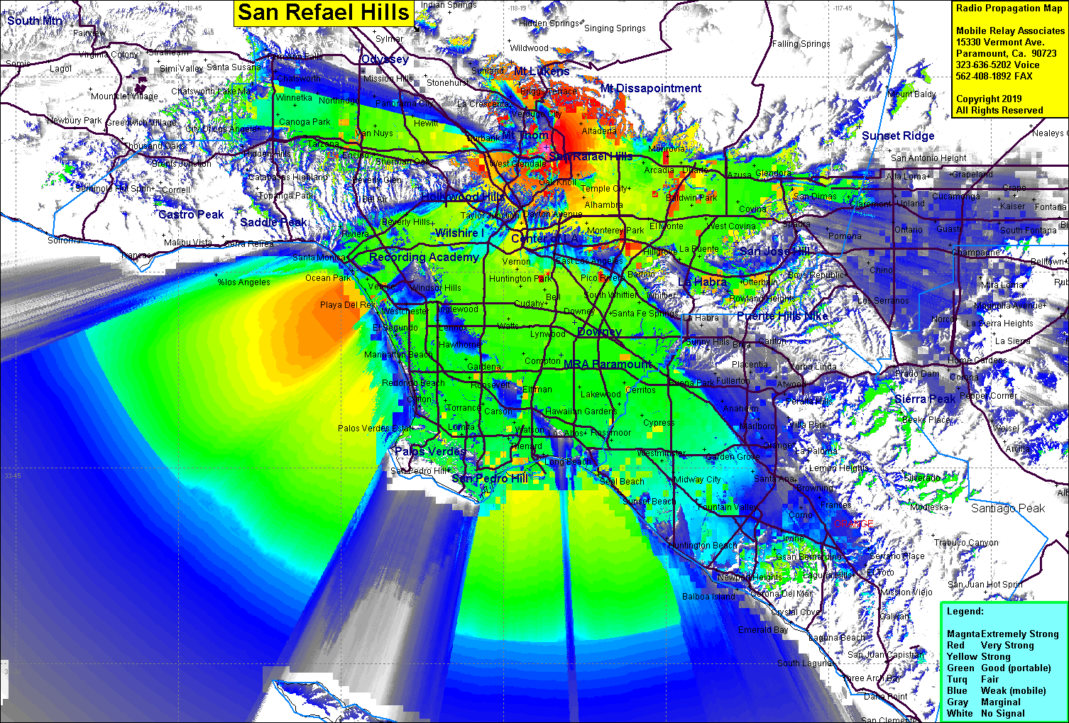 San Rafael Hills Coverage |
| Latitude: | 034 09 35.7N | 34.1599167 |
| Longitude: | 118 11 02.3W | -118.1839722 |
| Feet | Meters | |
| Ground Elevation: | 1,597.0 | 486.8 |
| HAAT: | 488.1 | 148.8 |
| City: | Glendale | |
| County: | Los Angeles | |
| State: | California |
This is not an MRA Owned Site. For space rental contact the site owner.
Do you own or manage this site? Click Here
Would you like to add a site to the Google Earth Map?? Click Here
Site Coverage: Coverage of the LA Basin, Orange County, San Gabriel Valley, southern San Fernando Valley, Altadena, Linda Vista
Amateur (ham) frequencies: