San Sevaine
| Site Name: | San Sevaine | 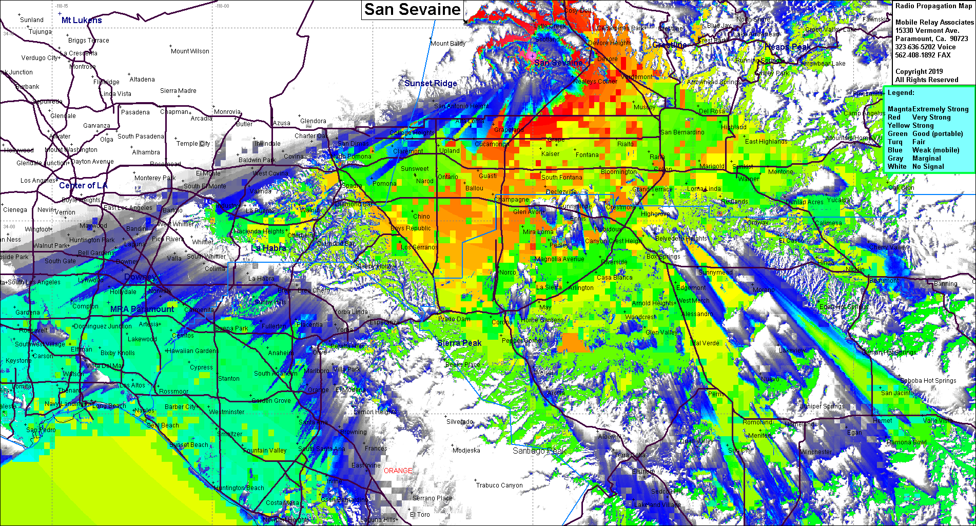 |
| Latitude: | 034 12 48.8N | 34.2135556 |
| Longitude: | 117 30 02.9W | -117.5008056 |
| Feet | Meters | |
| Ground Elevation: | 5,597.1 | 1,706.0 |
| HAAT: | 2,284.1 | 696.2 |
| City: | Lytle Creek | |
| County: | San Bernardino | |
| State: | California |
This is not an MRA Owned Site. For space rental contact the site owner.
Do you own or manage this site? Click Here
Would you like to add a site to the Google Earth Map?? Click Here
Site Coverage: Coverage of the Cajon Pass, San Bernardino, Rancho Cucamonga, Pomona, Corona, Riverside, Perris, north Orange County, south LA County
