Sandy
| Site Name: | Sandy | 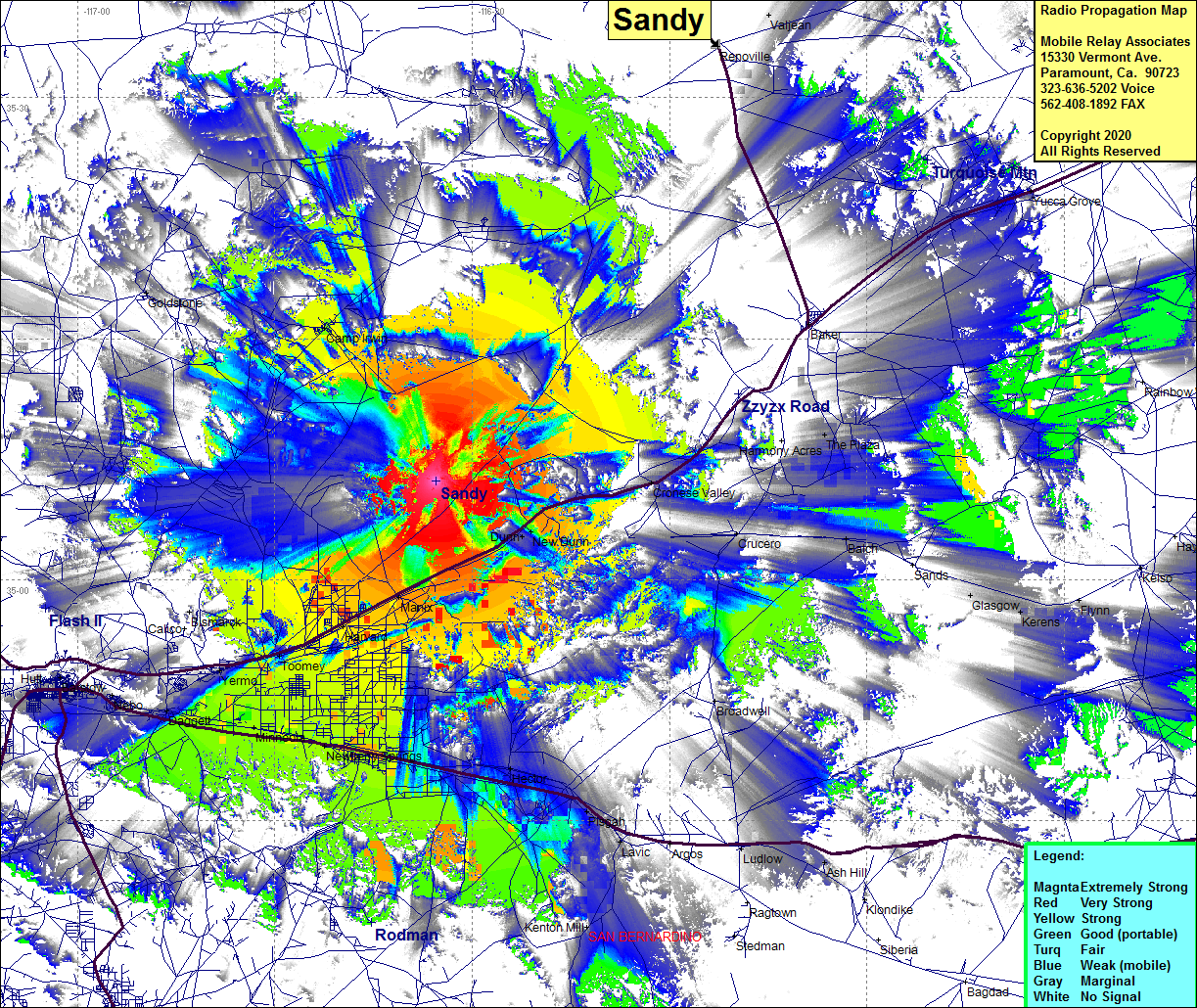 Sandy Coverage |
| Latitude: | 035 06 08.0N | 35.1022222 |
| Longitude: | 116 32 44.9W | -116.5458056 |
| Feet | Meters | |
| Ground Elevation: | 3149.9 | 960.1 |
| HAAT: | 1039.3 | 316.8 |
| City: | New Dunn | |
| County: | San Bernardino | |
| State: | California |
This is not an MRA Owned Site. For space rental contact the site owner.
Do you own or manage this site? Click Here
Would you like to add a site to the Google Earth Map?? Click Here
Site Coverage: Coverage of the Mojave Desert NE of Barstow, Nebo, Daggett, Minneola, Newbetty Springs, Hector, Pisgah, Yermo, Toomey, Harvard, Manix, Midway, Nnew Dunn, Cronese Valley, Camp Irwin, Goldstone, Crucero, Balch, Copper City, Barstow
Amateur (ham) frequencies: