Santa Anita Peak
| Site Name: | Santa Anita Peak | 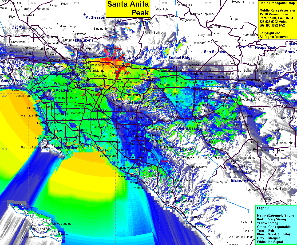 Santa Anita Peak Coverage |
| Latitude: | 034 11 14.3N | 34.1873056 |
| Longitude: | 118 02 06.7W | -118.0351944 |
| Feet | Meters | |
| Ground Elevation: | 3287.1 | 1001.9 |
| HAAT: | 1158.2 | 353.0 |
| City: | Sierra Madre | |
| County: | Los Angeles | |
| State: | California |
This is not an MRA Owned Site. For space rental contact the site owner.
Do you own or manage this site? Click Here
Would you like to add a site to the Google Earth Map?? Click Here
Site Coverage: Sierra Madre, Monrovia, Pasadena, Alhambra, Rosemead, El Monte, Covina, Baldwin Park, Azusa, Glendora, Hacienda Heights, La Verne, Ontario, Chino, Pomona, San Gabriel Valley, LA Basin, Orange County
Amateur (ham) frequencies: