Shirley Peak
| Site Name: | Shirley Peak | 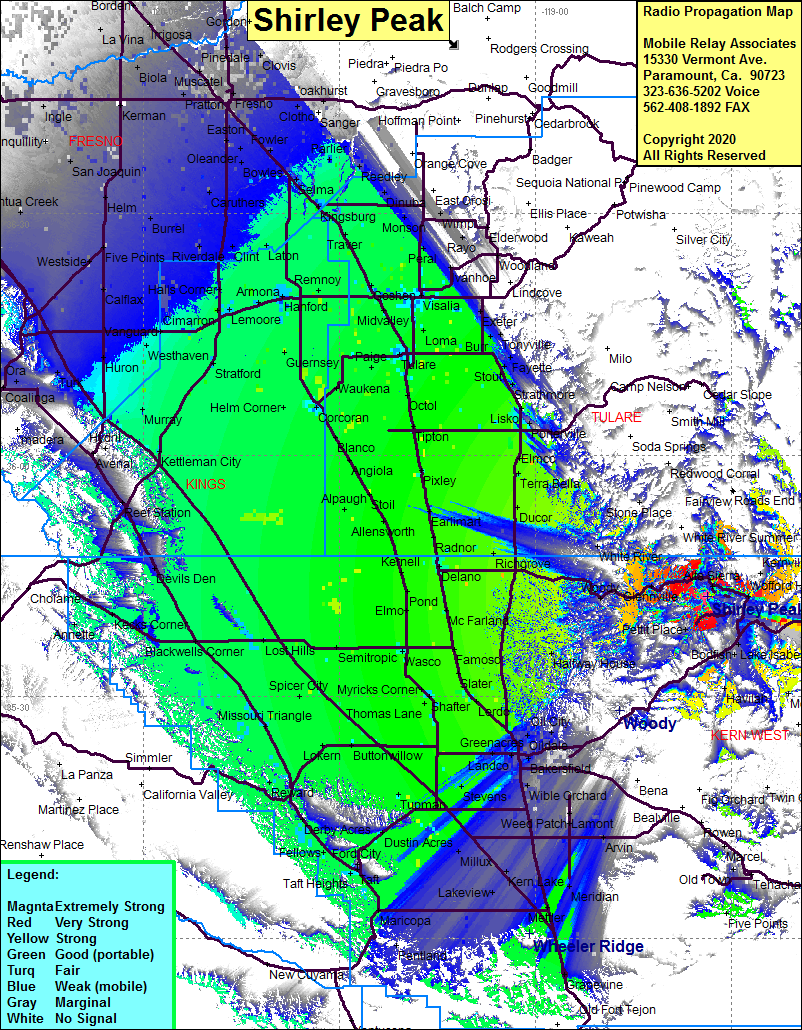 Shirley Peak Coverage |
| Latitude: | 035 42 25.7N | 35.7071389 |
| Longitude: | 118 33 39.0W | -118.5608333 |
| Feet | Meters | |
| Ground Elevation: | 7004.6 | 2135.0 |
| HAAT: | 2562.2 | 781.0 |
| City: | Alta Sierra | |
| County: | Kern | |
| State: | California |
This is not an MRA Owned Site. For space rental contact the site owner.
Do you own or manage this site? Click Here
Would you like to add a site to the Google Earth Map?? Click Here
Site Coverage: Coverage of the San Joaquin Valley south to Grapevine, north to Fresno, Mountain Mesa, Bella Vista, Weldon, Onyx, Moreland Mill, Lake Isabella, Bodfish, Pettit Place, Wofford Heights, Alta Sierra, Glenville, Woody, Halfway House, Oil City, Maltha, Kayandee, Mayfair, Oildale, Oil Junction, Bakersfield, Kern City, Greenacres
Amateur (ham) frequencies: