Silverwood
| Site Name: | Silverwood | 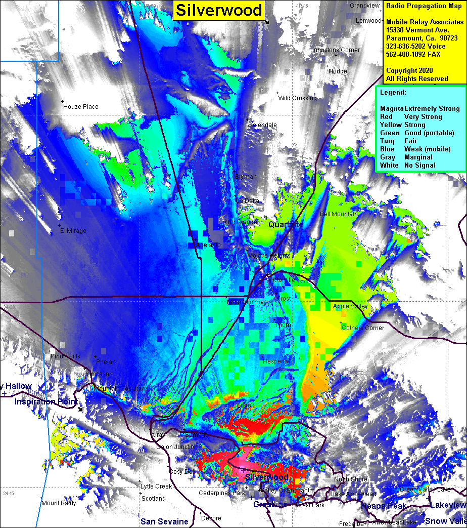 Silverwood Coverage |
| Latitude: | 034 16 22.9N | 34.2730278 |
| Longitude: | 117 19 49.8W | -117.3305000 |
| Feet | Meters | |
| Ground Elevation: | 4162.7 | 1268.8 |
| HAAT: | 760.1 | 231.7 |
| City: | Silverwood Lake | |
| County: | San Bernardino | |
| State: | California |
This is not an MRA Owned Site. For space rental contact the site owner.
Do you own or manage this site? Click Here
Would you like to add a site to the Google Earth Map?? Click Here
Site Coverage: Silverwood Lake, Lugo, Oak Hill, Herperia, Cotners Corner, Apple Valley, Summit, Phelan, Pinon Hills, Thom, Mountain View, Frost, Victorville, Oro Grande, Bell Mountain, La Delta, Bryman, Helendale
Amateur (ham) frequencies: