Sisar Radio Site
| Site Name: | Sisar Radio Site | 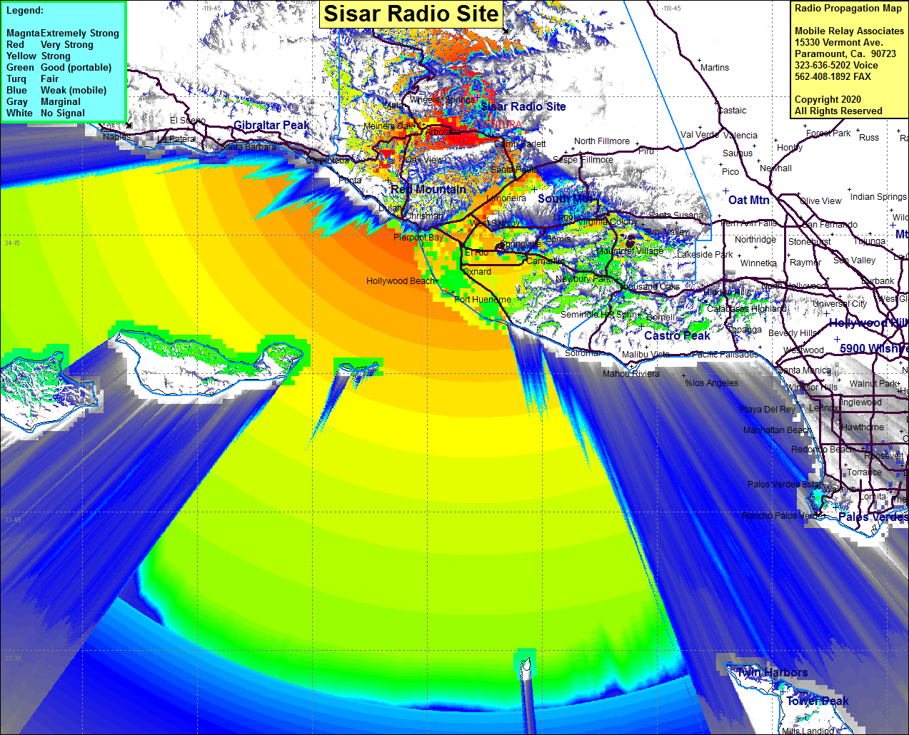 Sisar Radio Site Coverage |
| Latitude: | 034 29 57.6N | 34.4993333 |
| Longitude: | 119 08 29.2W | -119.1414444 |
| Feet | Meters | |
| Ground Elevation: | 5442.9 | 1659.0 |
| HAAT: | 2365.9 | 721.1 |
| City: | Ojai | |
| County: | Ventura | |
| State: | California |
This is not an MRA Owned Site. For space rental contact the site owner.
Do you own or manage this site? Click Here
Would you like to add a site to the Google Earth Map?? Click Here
Site Coverage: Coverage of Ojai Valley, Live Oak Acres, Arbolada, Oak View, Matilija Springs, Ojai, Mira Monte, Stauffer, Camp Barlett, Kevet, Santa Paula, Bardsdale, Oxnard, Port Hueneme, El Rio, Limineira, Santa Paula, West Saticoy, Kimball, Hollywood Beach, Newbury Park, Greenwich Village, Thousand Oaks, Malibu Junction, Virginia Colony, northern portion of Hwy 33 to Ojai Valley
Amateur (ham) frequencies: