Sky River
| Site Name: | Sky River | 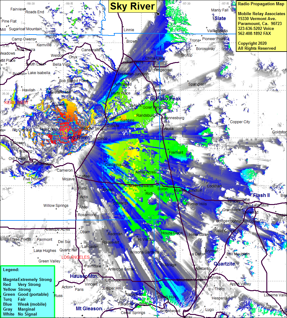 Sky River Coverage |
| Latitude: | 035 16 27.5N | 35.2743056 |
| Longitude: | 118 14 11.3W | -118.2364722 |
| Feet | Meters | |
| Ground Elevation: | 5459.0 | 1663.9 |
| HAAT: | 1209.8 | 368.8 |
| City: | Tehachapi | |
| County: | Kern | |
| State: | California |
This is not an MRA Owned Site. For space rental contact the site owner.
Do you own or manage this site? Click Here
Would you like to add a site to the Google Earth Map?? Click Here
Site Coverage: Coverage of Twin Oaks, Monolith, Sageland, Highway 14 from Cantil north to Highway 178 to Tehachapi, Caneda, Saltdale, Daley Mill, Harts Place, Amistead, Freeman Junction, Inyokern, Ridgecrest, China Lake, Garlock, Goler Heights, Rand, Gypsite
Amateur (ham) frequencies: