Tecate Peak
| Site Name: | Tecate Peak | 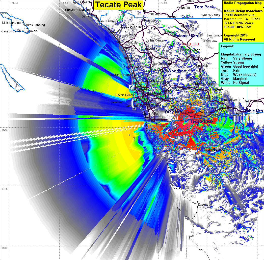 Tecate Peak Coverage |
| Latitude: | 032 34 45.3N | 32.5792500 |
| Longitude: | 116 41 20.3W | -116.6889722 |
| Feet | Meters | |
| Ground Elevation: | 3,882.9 | 1,183.5 |
| HAAT: | 2,217.6 | 675.9 |
| City: | Barrett Junction | |
| County: | San Diego | |
| State: | California |
This is not an MRA Owned Site. For space rental contact the site owner.
Do you own or manage this site? Click Here
Would you like to add a site to the Google Earth Map?? Click Here
Site Coverage: Coverage of Dulzura, Engineer Springs, Barrett Jct, Potero, Hacienda Del Flora, Barrett, Canyon City, Campo
Amateur (ham) frequencies: