Tepusquet Peak N
| Site Name: | Tepusquet Peak N | 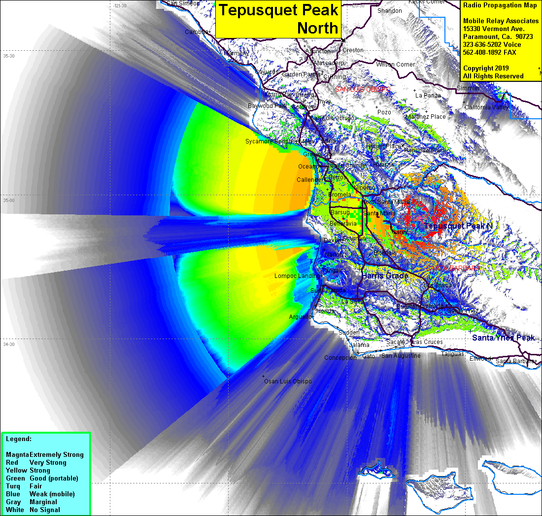 Tepusquet Peak N Coverage |
| Latitude: | 034 54 53.7N | 34.9149167 |
| Longitude: | 120 10 57.5W | -120.1826389 |
| Feet | Meters | |
| Ground Elevation: | 3244.1 | 988.8 |
| HAAT: | 1882.1 | 573.7 |
| City: | Santa Maria | |
| County: | Santa Maria | |
| State: | California |
This is not an MRA Owned Site. For space rental contact the site owner.
Do you own or manage this site? Click Here
Would you like to add a site to the Google Earth Map?? Click Here
Site Coverage: Santa Maria, Waldorf, Guadalupe, Barsug, Bragur, Carr, Pacer, Midco, Rosemary, Garey, Sisquoc, Bicnell, Los Alamos, Los Olivos, Ballard, Santa Ynez, Solvang, Buelton, Lompoc, La Salle, Baroda, Surf, Tangair, Narlon, Antonio, Casmalia, Orcutt, Bicknell
Amateur (ham) frequencies: