Tepusquet Peak
| Site Name: | Tepusquet Peak | 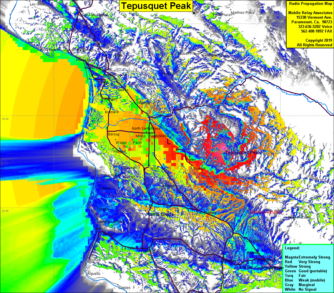 Tepusquet Peak Coverage |
| Latitude: | 034 54 36.9N | 34.9102500 |
| Longitude: | 120 11 12.3W | -120.1867500 |
| Feet | Meters | |
| Ground Elevation: | 3,248.0 | 990.0 |
| HAAT: | 1,919.5 | 585.1 |
| City: | Santa Maria | |
| County: | Santa Barbara | |
| State: | California |
This is not an MRA Owned Site. For space rental contact the site owner.
Do you own or manage this site? Click Here
Would you like to add a site to the Google Earth Map?? Click Here
Site Coverage: Coverage of Santa Maria, Orcutt, Sisquoc, Garey, Nipomo, Bromela, Barsug, Tangair, Pismo Beach, Berros
Amateur (ham) frequencies: