Thomas Mountain
| Site Name: | Thomas Mountain | 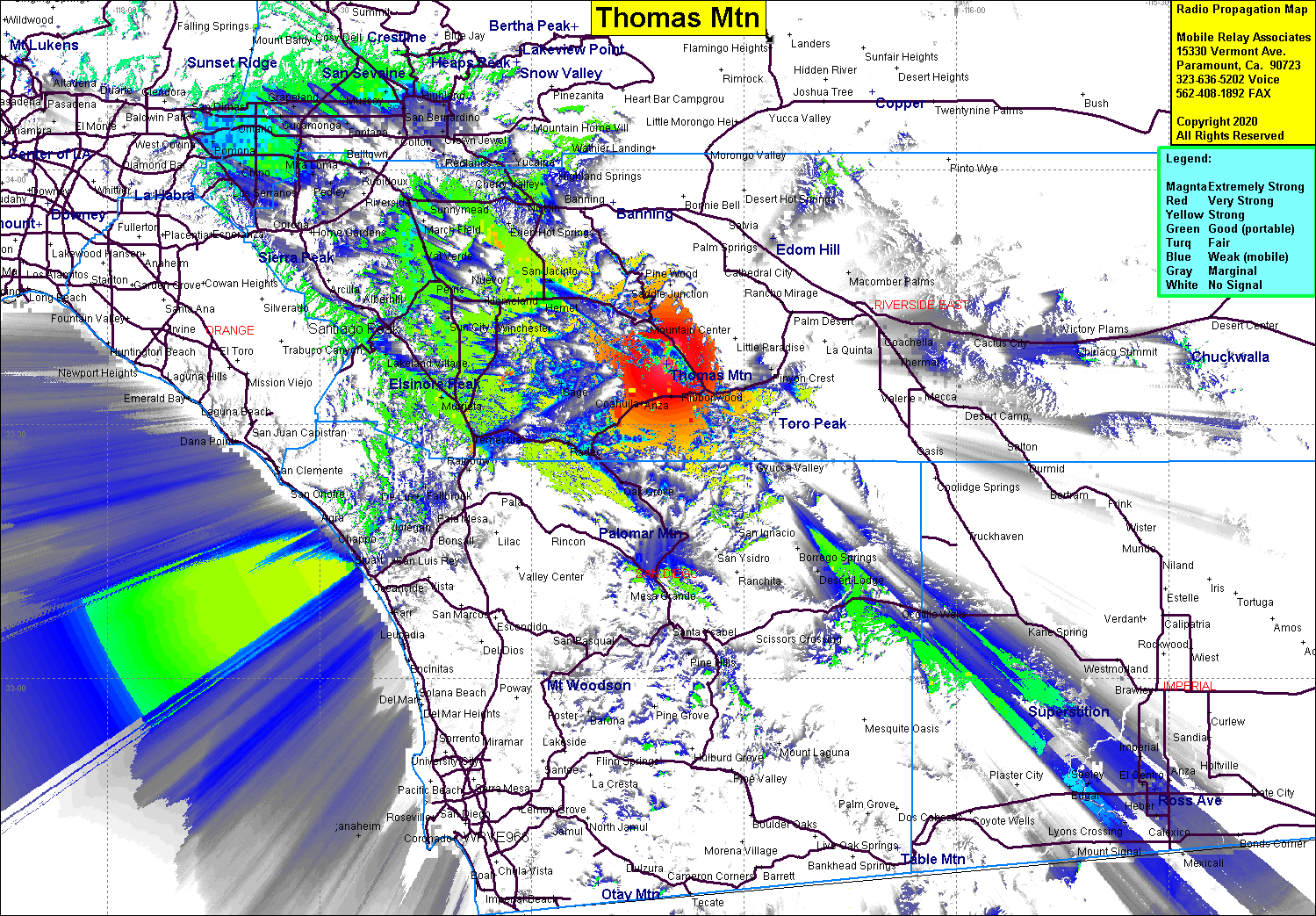 Thomas Mountain Coverage |
| Latitude: | 033 37 10.9N | 33.6196944 |
| Longitude: | 116 40 52.8W | -116.6813333 |
| Feet | Meters | |
| Ground Elevation: | 6836.0 | 2083.6 |
| HAAT: | 2511.3 | 765.4 |
| City: | Thomas Mountain | |
| County: | Riverside | |
| State: | California |
This is not an MRA Owned Site. For space rental contact the site owner.
Do you own or manage this site? Click Here
Would you like to add a site to the Google Earth Map?? Click Here
Site Coverage: Thomas Mountain, Anza, Coahuila, Redshank, Ribbonwood, Nightingale, Sage, Radec, Hemet, San Jacinto, Egan, Perris, Ellis, Murieta, Murieta Hot Springs, Temecula, Winterwarm, Wildomar, Terra Cotta, Aberhill, Winchester, Homeland, San Jacinto
Amateur (ham) frequencies: