Toro Peak
| Site Name: | Toro Peak | 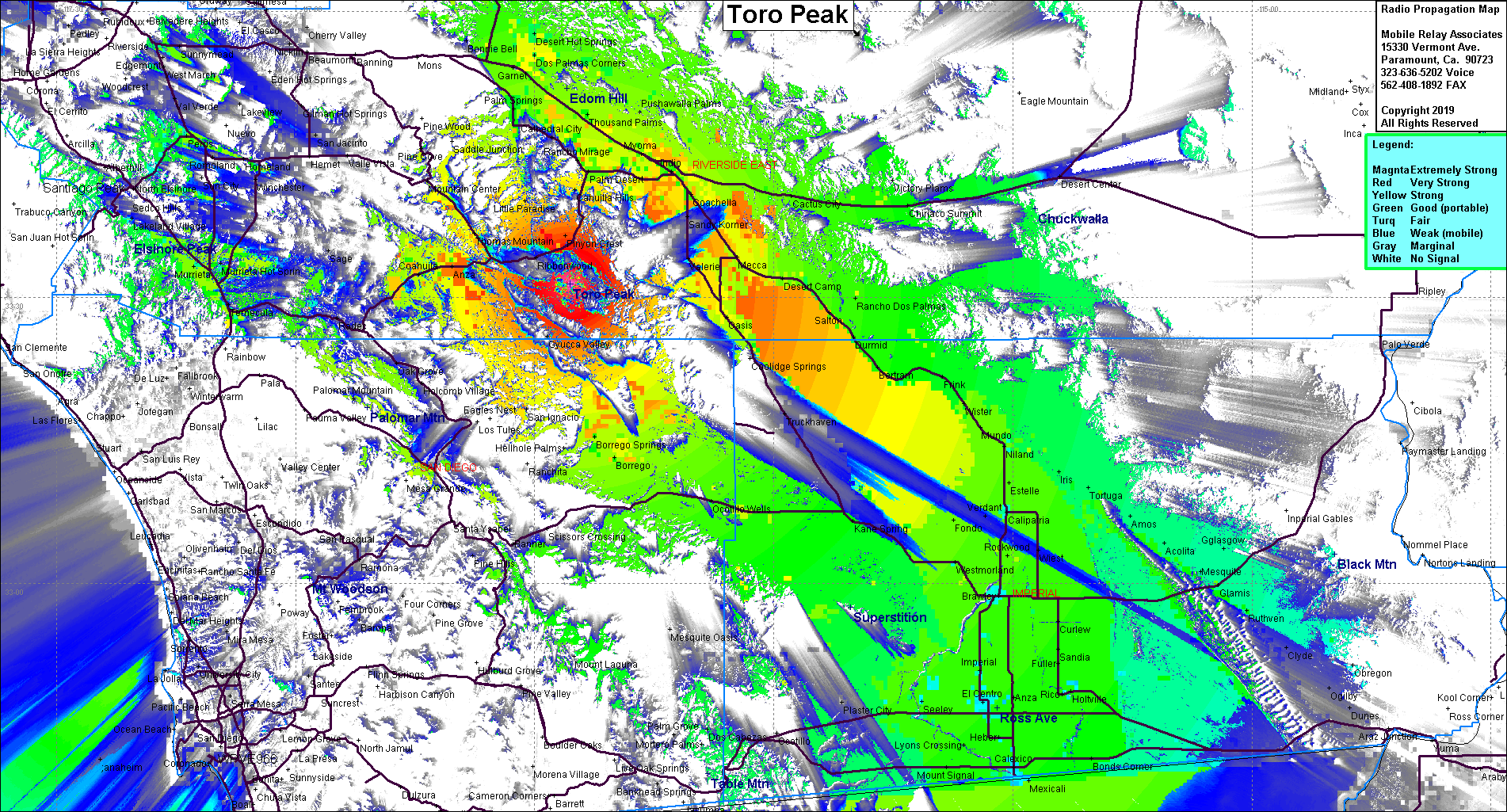 Toro Peak Coverage |
| Latitude: | 033 31 24.1N | 33.5233611 |
| Longitude: | 116 25 31.0W | -116.4252778 |
| Feet | Meters | |
| Ground Elevation: | 8,690.0 | 2,648.7 |
| HAAT: | 4,765.7 | 1,452.6 |
| City: | Nightingale | |
| County: | Riverside | |
| State: | California |
This is not an MRA Owned Site. For space rental contact the site owner.
Do you own or manage this site? Click Here
Would you like to add a site to the Google Earth Map?? Click Here
Site Coverage: Coverage of the Coachella Valley, Imperial Valley, east to Desert Center, San Bernardino area and west to Pomona
Amateur (ham) frequencies: