Torrance USD Tower
| Site Name: | Torrance USD Tower | 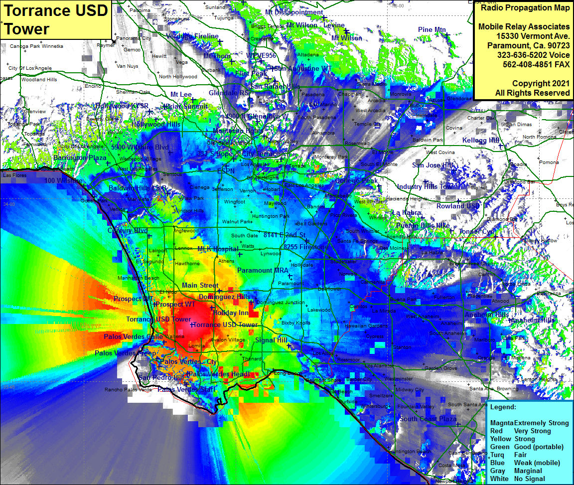 Torrance USD Tower Coverage |
| Latitude: | 033 49 40.1N | 33.8278056 |
| Longitude: | 118 19 19.8W | -118.3221667 |
| Feet | Meters | |
| Ground Elevation: | 83.0 | 25.3 |
| HAAT: | 140.1 | 42.7 |
| City: | Torrance | |
| County: | Los Angeles | |
| State: | California |
This is not an MRA Owned Site. For space rental contact the site owner.
Do you own or manage this site? Click Here
Would you like to add a site to the Google Earth Map?? Click Here
Site Coverage: Coverage of Torrance, Palos Verdes, San Pedro, Lomita, Avalon Village, Wilmington, Walteria, Dominguez, Manhattan Beach, El Segundo, LA Airport, Lennox, Hawthorne, Athens, Lynwood, Southgate, Walnut Park, Huntington Park, Maywood, Vernon, Inglewood, Winsor Hills, Westwood, Whittier, Friendly Hills, Lakewood, Cypress, Bixby Knolls, Hawaiian Gardens, La Mirada, Bellflower, Paramount
Amateur (ham) frequencies: