Winchester II
| Site Name: | Winchester II | 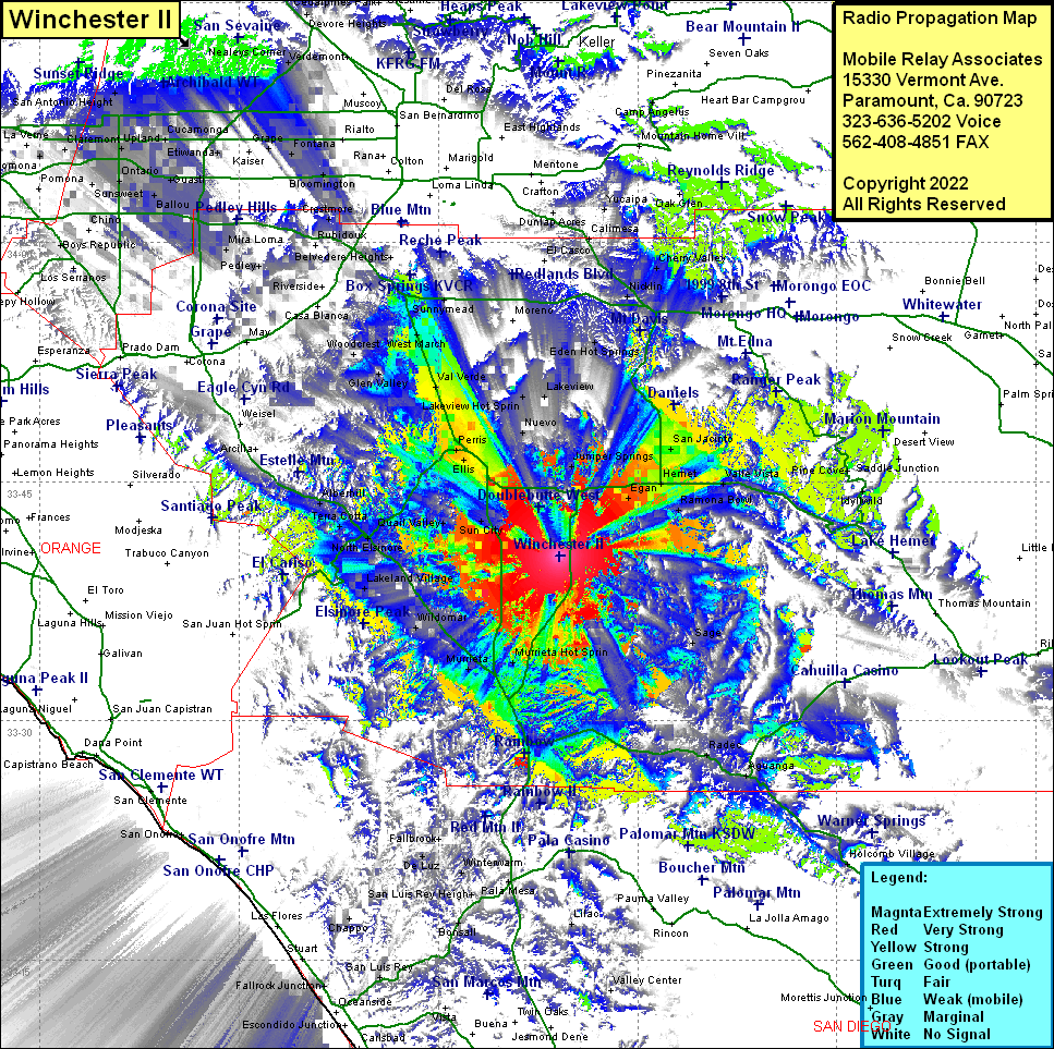 Winchester II Coverage |
| Latitude: | 033 40 22.1N | 33.6728056 |
| Longitude: | 117 05 51.6W | -117.0976667 |
| Feet | Meters | |
| Ground Elevation: | 1916.0 | 584.0 |
| HAAT: | 366.4 | 111.7 |
| City: | Winchester | |
| County: | Riverside | |
| State: | California |
This is not an MRA Owned Site. For space rental contact the site owner.
Do you own or manage this site? Click Here
Would you like to add a site to the Google Earth Map?? Click Here
Site Coverage: Coverage of Winchester, Egan, Hemet, San Jacinto, Soboba Hot Springs, Valle Vista, Ramona Bowl, Juniper Springs, Eden Hot Springs, Hinda, Nicklin, Beaumont, Cherry Valley, Highland Springs, Calimesa, Mountain Center, Saddle Junction, Redshank, Radec, Aguanga, Sage, Oak Grove, Holcomb Village, Murrieta Hot Springs, Murrieta, WIldomar, Sedco Holls, Lakeland Village, Elsinore, De Luz, San Luis Rey Heights, Pala Mesa, Jofegan, Sun City, Quail Valley, North Elsinore, Terra Cotta, Alberhill, Homeland, Romoland, Ellis, Perris, Nuevo, Lakeview Hot Springs, Lakeview, Val Verde, Alessandro, March Field, Arnold Heights, West March, Edgemont, Box Springs, Sunnymead, Glen Valley, Woodcrest, Mira Loma, Champagne, Ballou, Guasti, Rochester, Etiwanda, Cucamonga, Upland, Ontario, Alta Loma, Grapeland, San Antonio Heights, Kaiser, Grape, Fontana, Riverside Junction, Belltown, Crestmore, Ennis, Sunnyslope
Amateur (ham) frequencies: