Wind Farm
| Site Name: | Wind Farm | 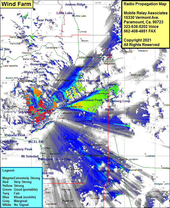 Wind Farm Coverage |
| Latitude: | 035 17 58.9N | 35.2996944 |
| Longitude: | 118 11 57.6W | -118.1993333 |
| Feet | Meters | |
| Ground Elevation: | 4583.0 | 1396.9 |
| HAAT: | 359.4 | 109.6 |
| City: | Tehachapi | |
| County: | Kern | |
| State: | California |
This is not an MRA Owned Site. For space rental contact the site owner.
Do you own or manage this site? Click Here
Would you like to add a site to the Google Earth Map?? Click Here
Site Coverage: Coverage of Sageland, Twin Oaks, Rancho Seco, Cantil, Daley Mill, Gypsite, Ricardo, Harts Place, Armistead, Freeman Junction, Moreland Mill, Chaffee, Mojave, Fleta, Sanborn, Bissell, California City, Aerial Acres, North Edwards, Desert Lake, Boron, Kramer Junction, Kramer Hills, Edwards, Ansel, Redman, Roosevelt, Oban, Hi Vista, House Place, Antelope Center, Littlerock, Pearblossom, Juniper Hills
Amateur (ham) frequencies: