Woody
| Site Name: | Woody | 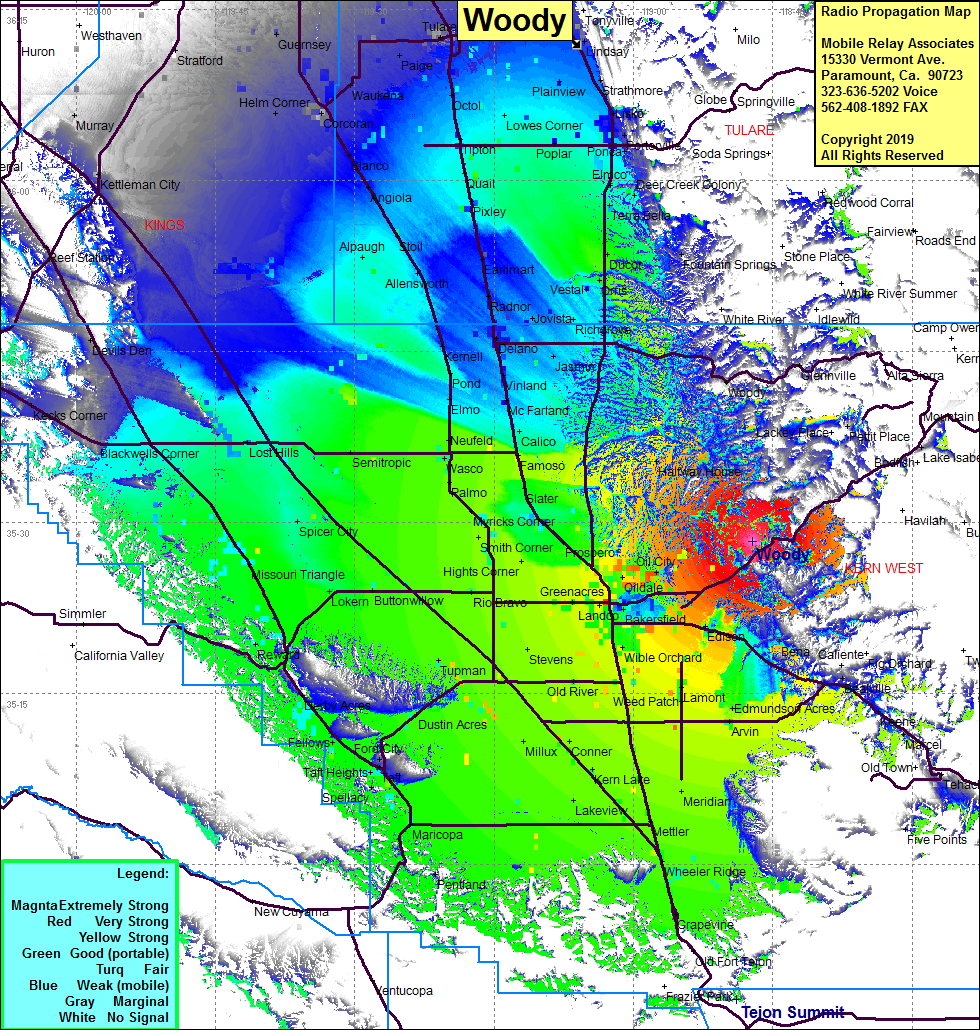 Woody Coverage |
| Latitude: | 035 28 19.9N | 35.4721944 |
| Longitude: | 118 47 09.0W | -118.7858333 |
| Feet | Meters | |
| Ground Elevation: | 3379.3 | 1030.0 |
| HAAT: | 1239.3 | 377.7 |
| City: | Oil City | |
| County: | Kern | |
| State: | California |
This is not an MRA Owned Site. For space rental contact the site owner.
Do you own or manage this site? Click Here
Would you like to add a site to the Google Earth Map?? Click Here
Site Coverage: Coverage of the San Joaquin Valley south to Grapevine and north past Tulare, Highway 178 from Bakersfield and east to half way to Lake Isabella
Amateur (ham) frequencies: