Wrightwood
| Site Name: | Wrightwood | 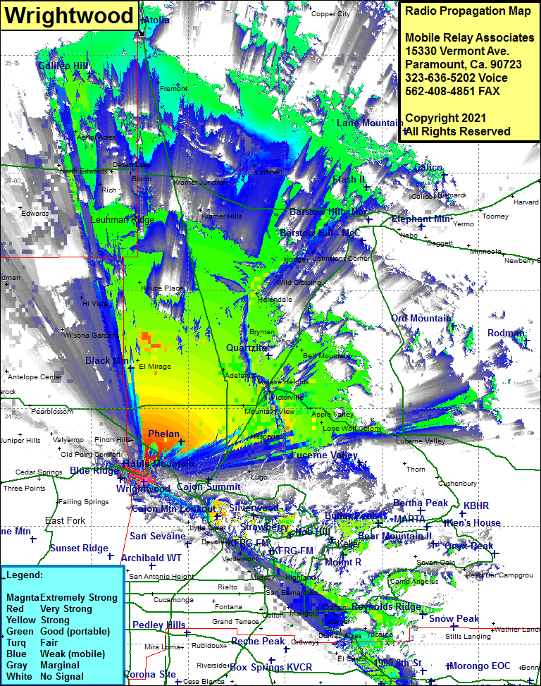 Wrightwood Coverage |
| Latitude: | 034 20 39.4N | 34.3442778 |
| Longitude: | 117 36 51.9W | -117.6144167 |
| Feet | Meters | |
| Ground Elevation: | 6334.0 | 1930.6 |
| HAAT: | 1,318.5 | 401.9 |
| City: | Wrightwood | |
| County: | San Bernardino | |
| State: | California |
This is not an MRA Owned Site. For space rental contact the site owner.
Do you own or manage this site? Click Here
Would you like to add a site to the Google Earth Map?? Click Here
Site Coverage: Coverage of Wrightwood, Phelan, Pinion Hills, El Mirage, Adelanto, Mountain View, Oro Grande, Bryman, La Delta, Mojave Heights, Victorville, Frost, Thorn, Hesperia, Lugo, Apple Valley, Cotners Corner, Bell Mountain, Helendale, Wild Crossing, Hodge, Johnstons Corner, Lenwood, Grandview
Amateur (ham) frequencies: