Wyleys Knob
| Site Name: | Wyleys Knob | 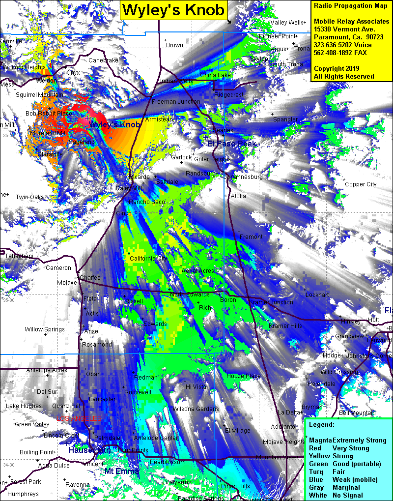 Wyleys Knob Coverage |
| Latitude: | 035 32 09.7N | 35.5360278 |
| Longitude: | 118 08 25.4W | -118.1403889 |
| Feet | Meters | |
| Ground Elevation: | 6,372.0 | 1,942.2 |
| HAAT: | 1,740.2 | 530.4 |
| City: | Inyokern | |
| County: | Kern | |
| State: | California |
This is not an MRA Owned Site. For space rental contact the site owner.
Do you own or manage this site? Click Here
Would you like to add a site to the Google Earth Map?? Click Here
Site Coverage: Coverage of Sageland, Claraville, Moreland Mill, Bob Rabbit Place, Weldon, Bella Vista, Armistad, Harts Place, Ricardo, off highway recreational area,
Amateur (ham) frequencies: