Roubiax Lake
| Site Name: | Roubiax Lake |  Roubiax Lake Coverage |
| Latitude: | 044 12 25.2N | 44.2070000 |
| Longitude: | 103 39 13.4W | -103.6537222 |
| Feet | Meters | |
| Ground Elevation: | 5489.0 | 1673.0 |
| HAAT: | 52.1 | 15.9 |
| City: | Roubiax | |
| County: | Lawrence | |
| State: | South Dakota |
This is not an MRA Owned Site. For space rental contact the site owner.
Do you own or manage this site? Click Here
Would you like to add a site to the Google Earth Map?? Click Here
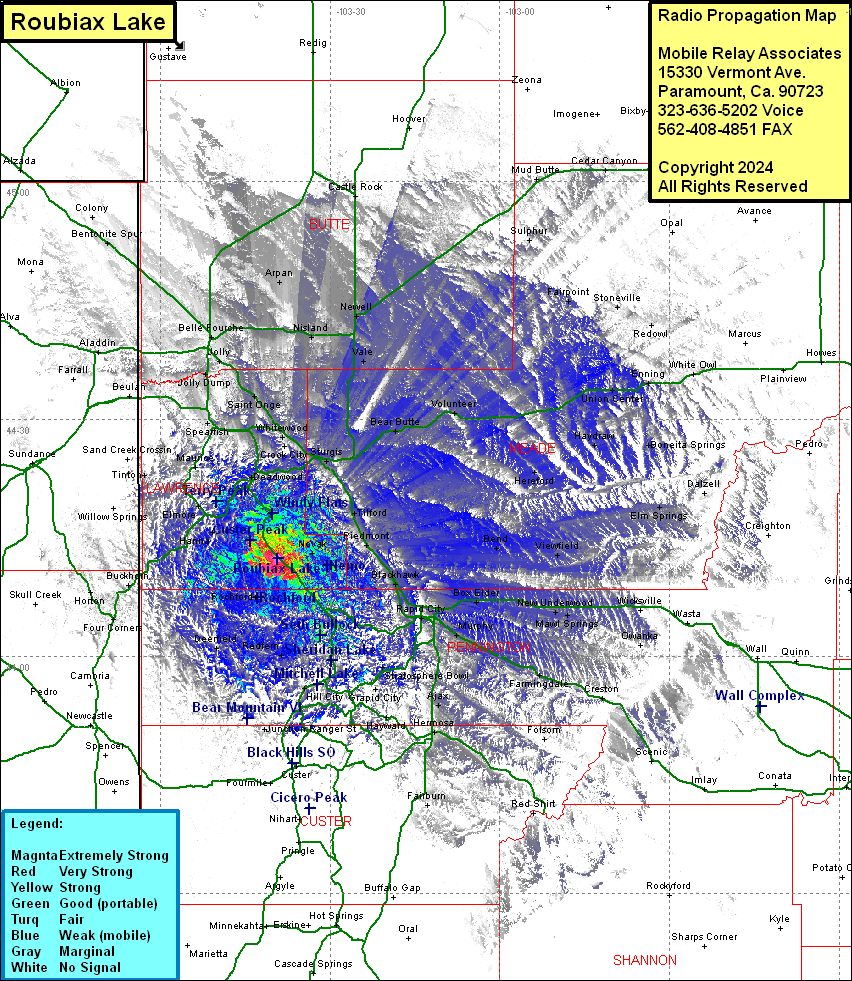
Site Coverage: Coverage of Galena, Crook City, Whitewood, Benchmark, Tomahawk, Arpan, Nisland, Newell, Vale, Castle Rock, Sturgis, Tilford, Piedmont, Bear Butte, Volunteer, Bend, Hereford, Viewfield, Haydraw, Boneita Springs, Elm Springs, Union Center, Fairpoint, Stoneville, Redowl, Enning, White Oak, Sulphur, Cedar Canyon, Mud Butte, Blackhawk, Mystic, Canyon City, Silver City, Johnson Siding, Big Bend, Hisega, Gossage Memorial, Rapid City, Schaeferville, Bol Elder, Gossage Memorial, Murphy, Warbonnet, Caputa, Neew Underwood, Mawl Springs, Wicksville, Owanka, Creston, Farmingdale, Folsom, Hermosa, Spokane, Berne, Hayward, Keystone, Grapid City, Rockerville, Stratosphere Bowl, Canadaville, Reno, Hill City, Tigerville, Redfern, Nahant, Nyersville, Deerfield, Horton, Four Corners, Vestal Springs, Junction Ranger Station, Dunmont, Hanna, Cheyenne Crossing, Elmore, Woodville, Roubiax, Englewood, Lead, Central City, Deadwood, Maitland, Terraville, Preston, Savoy, Victoria, Maurice, Beaver Crossing, Tinton, Spearfish, Saint Onge, Furitdale, Jolly, Bella Fourche, Jolly Dump, Belah, Alladin
