Veteran Peak
| Site Name: | Veteran Peak |  Veteran Peak Coverage |
| Latitude: | 044 19 57.6N | 44.3326667 |
| Longitude: | 103 32 21.8W | -103.5393889 |
| Feet | Meters | |
| Ground Elevation: | 5300.0 | 1615.4 |
| HAAT: | 1061.2 | 323.4 |
| City: | Tilford | |
| County: | Meade | |
| State: | South Dakota |
This is not an MRA Owned Site. For space rental contact the site owner.
Do you own or manage this site? Click Here
Would you like to add a site to the Google Earth Map?? Click Here
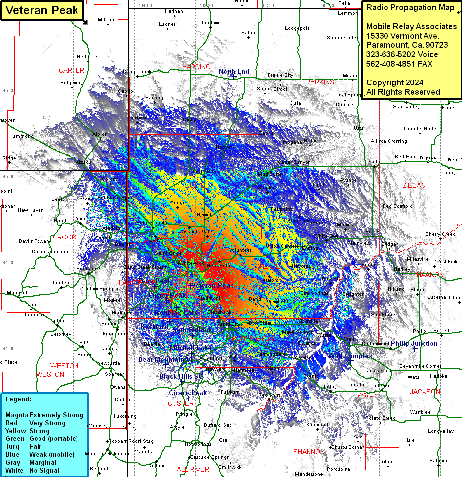
Site Coverage: Coverage of Sturgis, Bear Butte, Volunteer, Hereford, Haydraw, Boneita Springs, Dalzell, Union Center, Enning, White Owl, Plainview, Howes, Marcus, Redowl, Stoneville, Fairpoint, Sulphur, Opal, Avance, Faith, Maurine, Cedar Canyon, Mud Butte, Pedro, Hartley, Billsburg, Milesville, Bridger, Red Scaffold, Usta, Boxby, Imogene, Zeona, Date, Sorum, Vale, Newell, Castle Rock, Hoover, Cedig, Reva, Tilford, Piedmont, Blackhawk, Bend, Viewfield, Elm Springs, Creighton, Schaeferville, Box Elder, New Underwood, Mawl Springs, WIcksville, Wasta, Owanka, Wall, Quinn, Creston, Farmingdale, Caputa, Ajax, Hayward, Harney, Keystone, Grapid City, Stratosphere Bowl, McGee, Big Bend, Johnson Siding, Rapid City, Gossage Memorial, Murphy, Warbonnet, Spokane, Hermosa, Folsom, Fairburn, Red Shirt, Smithwick, Benchmark, Greenwood, Nahant, Dumont, Hanna, Cheyenne Crossing, Elmore, ENglewood, Woodville, Brownsville, Robiax, Galena, Lead, Terraville, Preston, Savoy, Willow Springs, Moskee, Buckhorn, Horton, Meyersville, Deerfield, Mystic, Canyon City, Silver Creek, Redfern, Tigerville, Five Points, Hill CIty, Reno, Oreville, Junction Ranger Station, Vestal Springs, Berne, Terraville, Trinton, Beaver Crossing, Maurice, Maitland, Deadwood, Crook City, Whitewood, Saint Onge, Spearfish, Jolly Dump, Jolly, Belle Fourche, Fruitdale, Nisland, Arpan, Redig, Gustave, Harding, Capital, Albion, Alzada, Ridge, Colony, Bentonite Spur, Mona, Seely, Hulett, Alva, Aladdin, Farrall, Beulah, Sand Creek, Sundance
