Wall Complex
| Site Name: | Wall Complex |  Wall Complex Coverage |
| Latitude: | 043 53 38.8N | 43.8941111 |
| Longitude: | 102 13 52.2W | -102.2311667 |
| Feet | Meters | |
| Ground Elevation: | 3047.0 | 928.7 |
| HAAT: | 397.2 | 121.1 |
| City: | Wall | |
| County: | Pennington | |
| State: | South Dakota |
This is not an MRA Owned Site. For space rental contact the site owner.
Do you own or manage this site? Click Here
Would you like to add a site to the Google Earth Map?? Click Here
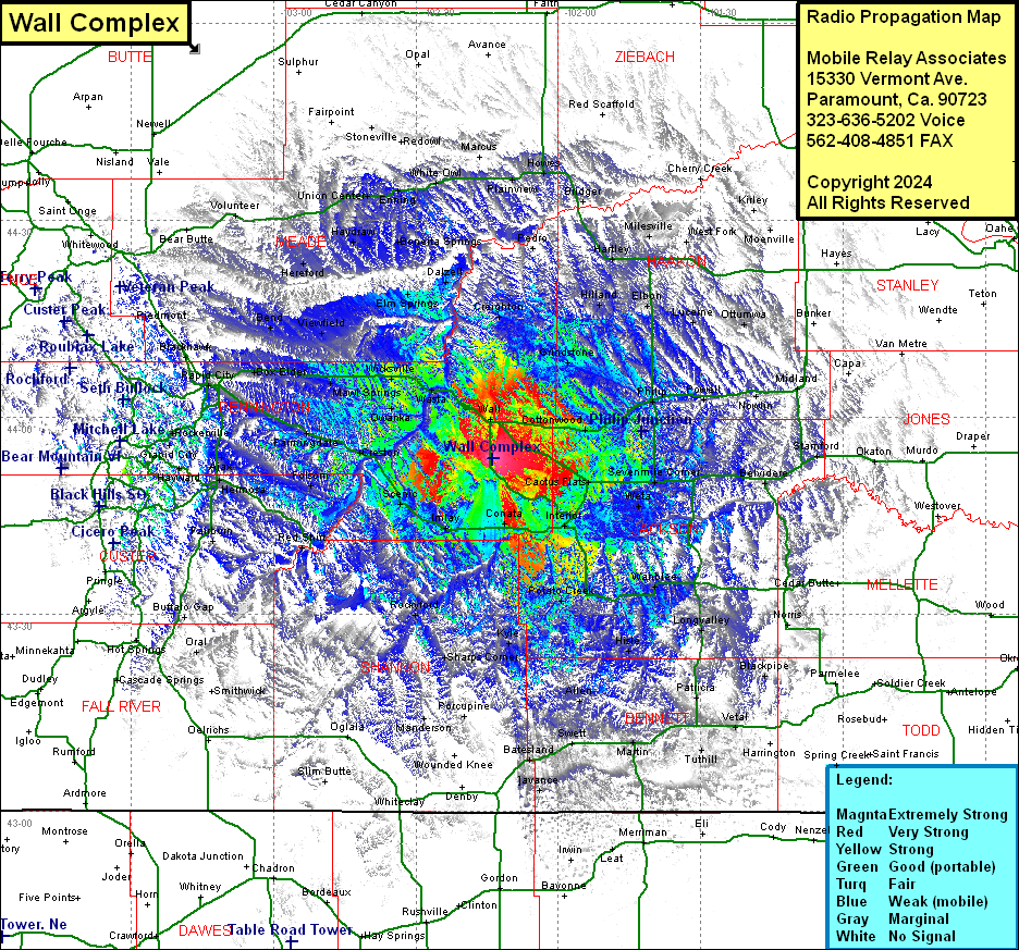
Site Coverage: Coverage of Quinn, Creighton, Pedro, Plainview, Howes, Cottonwood, Stamford, Okaton, Midland, Nowlin, Powell, Philip, Grindstone, Lucerne, Ottumwa, Elbon, Hilland, Hartley, Billsburg, Milesville, West Fork, Moenville, Bridger, Cherry Creek, Conata, Kyle, Cactus Flats, Sevenmile Corner, Kadoka Jct, Kadoka, Weta, Belvidere, Interior, Wanblee, Potato Creek, Longvalley, Hisle, Allen, Patricia, Vetal, Harrington, Turhill, Martin, Swett, Batesland, Avance, Blackpipe, Imlay, Scenic, Ajax, Hayward, Keystone, Orville, Spokane, Hermosa, Folsom, Red Shirt, Fairburn, Blue Bell, Rockyford, Sharps Corner, Manderson, Porcupine, Ogalala, Wall, Wasta, Wicksville, Owanka, Creston, Mawl Springs, New Underwood, Farmingale, Caputa, Box Elder, Murphy, Warbonnet, Ajax, Grapid City, Stratosphere Bowl, Murphy, Rapid City, Schaeferville, Blackhawk, Bend, Viewfield, Elm Springs, Dalzell, Boneita Springs, Haydraw, Hereford, Union Center, Enning, White Owl, Marcus, Stoneville
