Barneys Peak
| Site Name: | Barneys Peak | 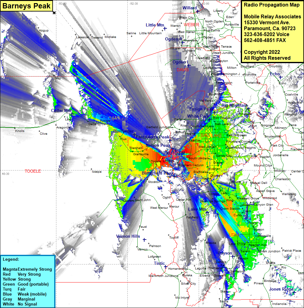 Barneys Peak Coverage |
| Latitude: | 040 35 05.7N | 40.5849167 |
| Longitude: | 112 10 27.5W | -112.1743056 |
| Feet | Meters | |
| Ground Elevation: | 8200.0 | 2499.4 |
| HAAT: | 2419.6 | 737.5 |
| City: | Copperton | |
| County: | Salt Lake | |
| State: | Utah |
This is not an MRA Owned Site. For space rental contact the site owner.
Do you own or manage this site? Click Here
Would you like to add a site to the Google Earth Map?? Click Here
Site Coverage: Coverage of Salt Lake City, Bacchus, Magna, Kearns. West Jordan, Endot, Saltair, West Warren, Clearfield, Layton, East Layton, North Farmington, Farmington, Centerville, Bountiful, Val Verda, Altus, East Millcreek, Holladay, Cottonwood Heights, Sandy City Draper, Riverton, Bluffdale, Oliver, Nash, Alpine, Clinton, Lehi, Wing, Wicks, Orem, Curtis, Provo, Ironton, Springville, Palmyra, Spanish Fork, Moark Junction, Salem, Payson, Glenota, Lant, Goshen, Elberta, Cedar Fort, Saint John, Clover, Ted Park, Tooele, Lincoln, Grantsville, Burmester, Timpia, Delle