Butterfield Peak
| Site Name: | Butterfield Peak | 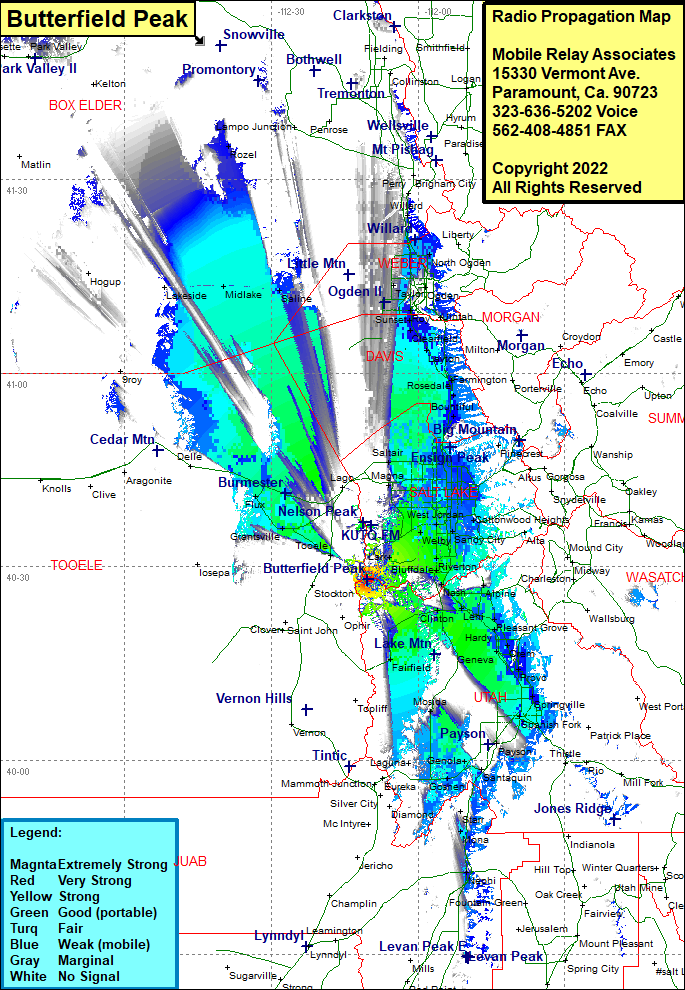 Butterfield Peak Coverage |
| Latitude: | 040 24 01.0N | 40.4002778 |
| Longitude: | 112 10 23.0W | -112.1730556 |
| Feet | Meters | |
| Ground Elevation: | 9368.0 | 2855.4 |
| HAAT: | 2579.6 | 786.3 |
| City: | Lark | |
| County: | Salt Lake | |
| State: | Utah |
This is not an MRA Owned Site. For space rental contact the site owner.
Do you own or manage this site? Click Here
Would you like to add a site to the Google Earth Map?? Click Here
Site Coverage: Coverage of Cedar Fort, Clinton, Lani, Goshen, Santaquin, Payson, Spanish Fork, Gomex, Springville, Provo, Orem, Snow, Hardy, Pleasant Grove, Alpine, Nash, Lehi, Riverton, Bluffdale, South Jordan, Sandy City, West Jordan, Jordan, East Millcreek, Val Verde, Bountiful, Beds, Centerville, Farmington, Clearfield, Uintah, Syracuse, Ogden, South Ogden, Willard