Cedar City
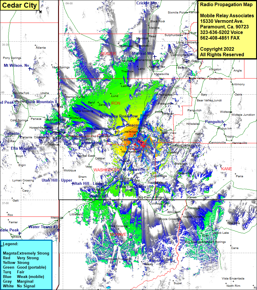
| Site Name: | Cedar City |  Cedar City Coverage |
| Latitude: | 037 32 29.6N | 37.5415556 |
| Longitude: | 113 04 07.6W | -113.0687778 |
| Feet | Meters | |
| Ground Elevation: | 10025.0 | 3055.6 |
| HAAT: | 2494.5 | 760.3 |
| City: | Cedar City | |
| County: | Iron | |
| State: | Utah |
This is not an MRA Owned Site. For space rental contact the site owner.
Do you own or manage this site? Click Here
Would you like to add a site to the Google Earth Map?? Click Here
Site Coverage: Coverage of Richfield, Alton, Mount Carmel, Mount Carmel Junction, Virgin, Big Plain Junction, La Verkin, Nagles Crossing, Booze Crossing, Ryan, Jacob Lake, Big Springs, Mangum Springs, Rock Crossing, Mesquite, Bunkerville, Joseco, Acoma, Brown, Crestline, Uvada, Modena, Heist, Yale Crossing, Beryl, Zane, Lund, Latimer, Thermo, Laho, Cook Corner, Milard, Murdock, Blueacre, Newhouse, Hamlin Valley, Minersville, Cunningham Hill, Wheatgrass, Fort Johnson, Enoch, Cedar City, Hamiltons Fort, North View, Glendale, Orderville, Mount Carmel Junction, Harrisburg, Harrisburg Jct, Hurricane, Pintura, Silver Reef, Leeds, Big Plain Junction, Rock Crossing, Mangum Springs, Big Springs, Mesquite, Bunkerville
