Cove Mtn
| Site Name: | Cove Mtn | 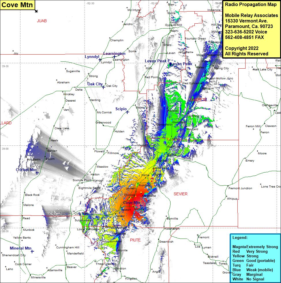 Cove Mtn Coverage |
| Latitude: | 038 38 00.9N | 38.6335833 |
| Longitude: | 112 03 36.6W | -112.0601667 |
| Feet | Meters | |
| Ground Elevation: | 8786.0 | 2678.0 |
| HAAT: | 1539.4 | 469.2 |
| City: | Monroe | |
| County: | Servier | |
| State: | Utah |
This is not an MRA Owned Site. For space rental contact the site owner.
Do you own or manage this site? Click Here
Would you like to add a site to the Google Earth Map?? Click Here
Site Coverage: Coverage of Joseph, Sevier, Belknap, Marysvale, Thompsonville, Alunite, Bullion Falls, Cove Fort, Elsinore, Nibley, Central, Annabella, Jensen, Richfield, Gramse, Kema, Venice, Prattsville, Glenwood, Sigurd, Vermillion, Aurora, Salina, Redmond, Axtell, Centerfield, Gunnison, Mayfield, Fayette, Sterling, Ephraim, West Ephraim, Pigeon Hole, Chester, Moroni, Mount Pleasant, Spring City, Fairview, Oak Creek