Cricket Mtn
| Site Name: | Cricket Mtn | 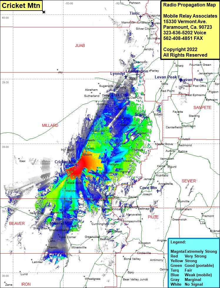 Cricket Mtn Coverage |
| Latitude: | 038 49 58.3N | 38.8328611 |
| Longitude: | 112 52 17.3W | -112.8714722 |
| Feet | Meters | |
| Ground Elevation: | 5309.0 | 1618.2 |
| HAAT: | 159.3 | 48.5 |
| City: | Bloom | |
| County: | Millard | |
| State: | Utah |
This is not an MRA Owned Site. For space rental contact the site owner.
Do you own or manage this site? Click Here
Would you like to add a site to the Google Earth Map?? Click Here
Site Coverage: Coverage of Iron Basin, Bloom, Borden, Neels, Clear Lake, Van, Oasis, Deseret, Hinckley, Delta, Sutherland, Sugarville, Strong, Oak City, Harding, McCormick, Greenwood, Holden, Champlin, Lynndyl, Flowell, Fillmore, Meadow, Hatton, Kanosh, Sixmile Point, Eightmile Point, Cove Fort, Sulphurdale, Manderfield, Black Rock, Malone, Read, Murdock, Yellow Banks, Millford, Blueacre, Frisco, Upton, Cook Corner, Leho, Shenendoah City