Lead Mountain II
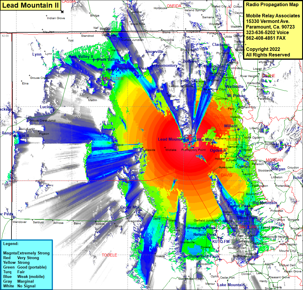
| Site Name: | Lead Mountain II |  Lead Mountain II Coverage |
| Latitude: | 041 15 28.1N | 41.2578056 |
| Longitude: | 112 26 27.0W | -112.4408333 |
| Feet | Meters | |
| Ground Elevation: | 6580.0 | 2005.6 |
| HAAT: | 2212.2 | 674.3 |
| City: | Saline | |
| County: | Box Elder | |
| State: | Utah |
This is not an MRA Owned Site. For space rental contact the site owner.
Do you own or manage this site? Click Here
Would you like to add a site to the Google Earth Map?? Click Here
Site Coverage: Coverage of Blue Creek, Howell, Plymouth, Lampo Junction, Penrose, Thatcher, Bothwell, Tremonton, Elwood, Cropley, Bradford, Bear River City, Corinne, Honeyville, Madsen, Deweyville, Riverside, Fielding, Wheelon, Brigham City, Perry, Willard, Nerva, Pleasant View, North Ogden, Farr West, Plain City, Warren, Wests Weber, Marriott, Harrisville, Fairmont, Five Points, Wilson, Ogden, Kanesville, Taylor, Riverdale, Roy, Barton, West Point, Barnes, Syracuse, Clearfield, Laytona, Layton, Kaysville, Fruit Heights, East Layton, South Weber, Uintah, Washington Terrace, North Farmington, Farmington, Rosedale, Valenca, Centerville, Bountiful, Woods Cross, Val Verda, North Salt Lake, Becks, Fort Douglas, Foothill Village, South Salt Lake, Salt Lake City, Roper, Sugar House, East Millcreek, Holladay, Knudsens Corner, Cottonwood Heights, Granite, Sandy City, Endot, South Jordan, Riverton, Riverton Siding, Welby, Kearns, Hunter, Redwood, Terminal, Buena Vista, Riter, Saltair, Magna, Bacchus, Garfield Jct, Lake Point Jct, Lago, Lake Point, Mills Jct, Erda, Marshall, Grantsville, Lincoln, Tooele, Tad Park, Bauer, Stockton, Saline, Midlake, Tresend, Lakeside, Hogup, Burmester, Flux, Timpie, Delle, Low, Aragonite, Clive, Knolls, Barro, Matlin, Hardup, Rosette, Cedar Creek, Curlew Jct, Snowville, Blue Creek, Howell, Lampo Junction
