Lead Mountain
| Site Name: | Lead Mountain | 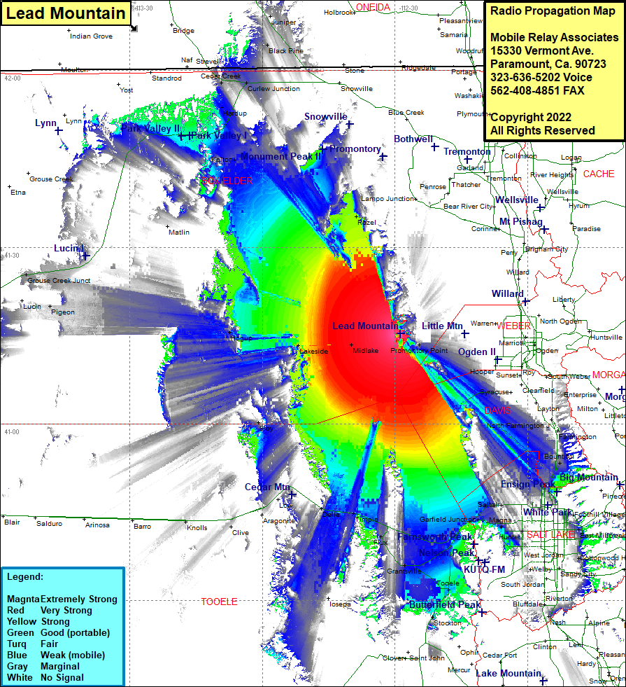 Lead Mountain Coverage |
| Latitude: | 041 15 22.5N | 41.2562500 |
| Longitude: | 112 28 46.2W | -112.4795000 |
| Feet | Meters | |
| Ground Elevation: | 5047.0 | 1538.3 |
| HAAT: | 626.9 | 191.1 |
| City: | Saline | |
| County: | Box Elder | |
| State: | Utah |
This is not an MRA Owned Site. For space rental contact the site owner.
Do you own or manage this site? Click Here
Would you like to add a site to the Google Earth Map?? Click Here
Site Coverage: Coverage of Fruit Heights, Farmington, Centerville, Bountiful, Val Verda, Salt Lake City, North Salt Lake, Woods Crossing, Rosedale, Becks, Saltair, Welby, Lincoln, Tooele, Tad Park, Bauer, Stockton, Magna, Garfield Junction, Lake Point Junction, Erda, Grantsville, Josepa, Flux, Timpie, Delle, Low, Aragonite, Clive, Knolls, Saline, Midlake, Tresend, Lakeside, Promontory Point, Little Mountain, Pigeon, Rozel, Kelton, Matlin, Hardup, Rosette, Curlew Junction, Cedar Creek, Black Pine, Juniper, Hogup