Levan Peak E
| Site Name: | Levan Peak E | 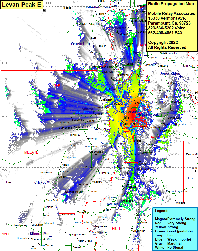 Levan Peak E Coverage |
| Latitude: | 039 29 31.2N | 39.4920000 |
| Longitude: | 111 49 40.3W | -111.8278611 |
| Feet | Meters | |
| Ground Elevation: | 8344.0 | 2543.3 |
| HAAT: | 2014.6 | 614.0 |
| City: | Levan | |
| County: | Juab | |
| State: | Utah |
This is not an MRA Owned Site. For space rental contact the site owner.
Do you own or manage this site? Click Here
Would you like to add a site to the Google Earth Map?? Click Here
Site Coverage: Coverage of Red Point, Fayette, Gunnison, Centerfield, Axtel, Redmond, Salina, Aurora, Vermillion, Sigurd, Kema, Annabella, Holden, Greenwood, Flowell, Hatton, Eightmile Point, Hinckley, Abraham, Delta, Sutherland, Sugarville, Strong, Spring City, Juab, Levan, Sharp, Nephi, Gypsum Mill, Soma, Lynndyl, Champlin, Jericho, McIntyre, Silver City, Mammoth Junction, Eureka, Elverta, Laguna, Goshen, Santaquin, Genola, Fountain Queen, Mount Pleasant, Hill Top, Gypsum Mill, Nona, Starr, Genola, Payson, Lake Shore, Mosida, Laguna, Eureka, Lofgreen, Fairfield, Cedar Fort, Saratoga Springs, Hardy, Pleasant Grove, Lehi, Alpine, West Mercur, Faust, Hill Top, Milburn, Oak Creek, Fairview, Spring City, Pigeon Hollow Junction, West Ephraim, Ephraim, Chester, Sharp, Sugarville, Strong, Sutherland, Bloom, Sixmile Point, Eightmile Point, Meadow, Flowell, Holden, Greenwood