Lucin I
| Site Name: | Lucin I | 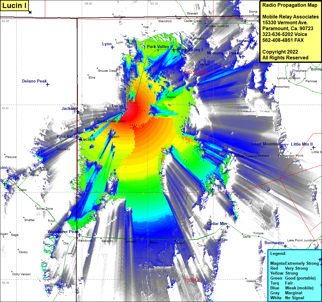 Lucin I Coverage |
| Latitude: | 041 28 33.0N | 41.4758333 |
| Longitude: | 113 39 58.9W | -113.6663611 |
| Feet | Meters | |
| Ground Elevation: | 5974.0 | 1820.9 |
| HAAT: | 1027.6 | 313.2 |
| City: | Lucin | |
| County: | Box Elder | |
| State: | Utah |
This is not an MRA Owned Site. For space rental contact the site owner.
Do you own or manage this site? Click Here
Would you like to add a site to the Google Earth Map?? Click Here
Site Coverage: Coverage of Rosette, Hardup, Kelton, Matlin, Hogup, Lakeside, Tresend, Midlake, Saling, Promontory Point, Sroy, Arinosa, Barro, Knolls, Grouse Creek Junction, Lucin, Pigeon, Tecoma, Montello, Loray, Cobre