Lynndyl
| Site Name: | Lynndyl | 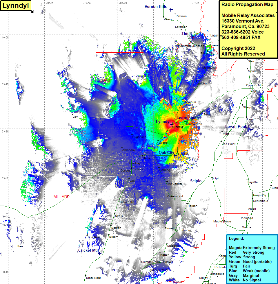 Lynndyl Coverage |
| Latitude: | 039 31 06.5N | 39.5184722 |
| Longitude: | 112 22 47.0W | -112.3797222 |
| Feet | Meters | |
| Ground Elevation: | 4793.0 | 1460.9 |
| HAAT: | -112.0 | -34.1 |
| City: | Lynndyl | |
| County: | Millard | |
| State: | Utah |
This is not an MRA Owned Site. For space rental contact the site owner.
Do you own or manage this site? Click Here
Would you like to add a site to the Google Earth Map?? Click Here
Site Coverage: Coverage of Lynndyl, Champlin, Hericho, Soma, Parley, Uisco, Learnington, McIntyre, Diamond, Dennis, Tintic Junction, Mammoth Junction, Oak City, Greenwood, Mills, Strong, Sugarville, Sutherland, Abraham, Delta, Hinckley, Deseret, Oasis, Van, Harding, McCormick, Clear Lake, Neels, Bordero, Silver City