Midvalley Road Tower
| Site Name: | Midvalley Road Tower | 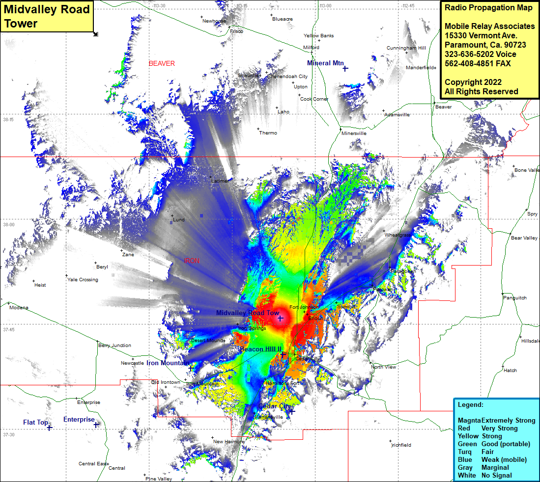 Midvalley Road Tower Coverage |
| Latitude: | 037 45 50.8N | 37.7641111 |
| Longitude: | 113 06 18.4W | -113.1051111 |
| Feet | Meters | |
| Ground Elevation: | 5500.0 | 1676.4 |
| HAAT: | -233.8 | -71.3 |
| City: | Cedar City | |
| County: | Iron | |
| State: | Utah |
This is not an MRA Owned Site. For space rental contact the site owner.
Do you own or manage this site? Click Here
Would you like to add a site to the Google Earth Map?? Click Here
Site Coverage: Coverage of Cedar City, Desert Mound, Hamiltons Fort, Fort Johnson, Enoch, Summit, Phill, Parawan, Paragonah, Wheatgrass, Cook Corner, Halivah, Hamiltons Fort, Desert Mound, Iron Springs, Kanarraville, Avon, Lund, Latimer, Shauntie