Montezuma Creek
| Site Name: | Montezuma Creek |  Montezuma Creek Coverage |
| Latitude: | 037 17 39.8N | 37.2943889 |
| Longitude: | 109 16 17.1W | -109.2714167 |
| Feet | Meters | |
| Ground Elevation: | 4984.0 | 1519.1 |
| HAAT: | 245.3 | 74.8 |
| City: | Montezuma Creek | |
| County: | San Juan | |
| State: | Utah |
This is not an MRA Owned Site. For space rental contact the site owner.
Do you own or manage this site? Click Here
Would you like to add a site to the Google Earth Map?? Click Here
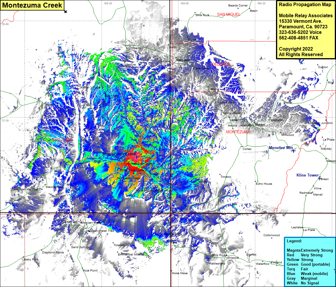
Site Coverage: Coverage of Eastland, Ucolo, Northdale, Dove Creek, Cahone, Pleasant View, Yellow Jacket, Lewis, Lebanon, Dolores, Stapleton, Roundup Junction, Arenth, White Mesa Village, Mariano, Teec Nos Pas, Twin Falls, Copper Mine, Montezuma Creek, Red Lake Village, White Rock Curve, Red Mesa, Mexican Water, Tes Nez Iah, Mexican Water Trading Post, Bluff, Blanding, Indian Village
