Monument Peak III
| Site Name: | Monument Peak III | 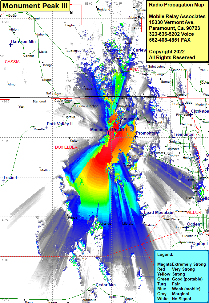 Monument Peak III Coverage |
| Latitude: | 041 46 36.9N | 41.7769167 |
| Longitude: | 112 46 19.1W | -112.7719722 |
| Feet | Meters | |
| Ground Elevation: | 5129.0 | 1563.3 |
| HAAT: | 590.4 | 180.0 |
| City: | Snowville | |
| County: | Box Elder | |
| State: | Utah |
This is not an MRA Owned Site. For space rental contact the site owner.
Do you own or manage this site? Click Here
Would you like to add a site to the Google Earth Map?? Click Here
Site Coverage: Coverage of Snowville, Blue Creek, Howell, Stone, Holbrook, Cedarhill, Buist, Holbrook Summit, Promontory, Rozel, Lampo Junction, Madsen, Brigham City, Midlake, Tresend, Lakeside, Hogup, Hardup, Cedar Creek, Curlew Junction, Black Pine, Juniper, Roy Summit