Payson
| Site Name: | Payson | 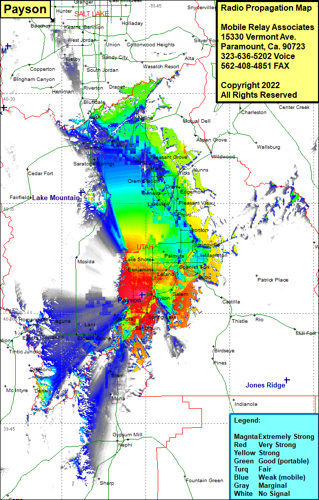 Payson Coverage |
| Latitude: | 040 02 28.8N | 40.0413333 |
| Longitude: | 111 45 39.0W | -111.7608333 |
| Feet | Meters | |
| Ground Elevation: | 4617.0 | 1407.3 |
| HAAT: | -502.3 | -153.1 |
| City: | Payson | |
| County: | Utah | |
| State: | Utah |
This is not an MRA Owned Site. For space rental contact the site owner.
Do you own or manage this site? Click Here
Would you like to add a site to the Google Earth Map?? Click Here
Site Coverage: Coverage of Payson, Sales, Leland, Benjamin, Lake Shore, Spanish Fork, Palmyra, Springville, Ironton, Provo, Lakeview, Pleasant View, Edgemont, Snow, Geneva, Orem Station, Orem, Edgemont, Wicks, Lindon, American Fork, Wing, Saratoga Springs, Clinton, Lehi, Alpine, Bluffdale, Roverton, Welby, Spring Lake, Santaquin, Genola, Goshen, Lant, Starr, Mona, Lagona, Hillside, Eureka, Dividend