Randolph
| Site Name: | Randolph | 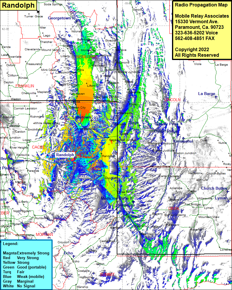 Randolph Coverage |
| Latitude: | 041 38 13.7N | 41.6371389 |
| Longitude: | 111 24 56.2W | -111.4156111 |
| Feet | Meters | |
| Ground Elevation: | 8747.0 | 2666.1 |
| HAAT: | 1439.6 | 438.8 |
| City: | Logan | |
| County: | Cache | |
| State: | Utah |
This is not an MRA Owned Site. For space rental contact the site owner.
Do you own or manage this site? Click Here
Would you like to add a site to the Google Earth Map?? Click Here
Site Coverage: Coverage of Randolph, Sage Creek Jct, Jaketown, Meadowville, Pickelville, Garden City, Lakota, Fish Haven, Saint Charles, Lifton, Turnpike, Lifton, Bloomington, Paris, Ovid, Woodboro, Dingle, Harer, Alton, Pegram, Montpelier, Hellhole, Bem, Geneva, Raymond, Border Junction, Alton, Harer, Chausse, Border, Pegram, Cokeville, Maruse, Pixley, Beckwith, Sage Creek Jct, Carlson, Sage, Mount Sterling, Clarkston, Newton, Cache Junction, Old Limber Pine, Arexburg, Lanake, Liberty, Sharon