Tintic
| Site Name: | Tintic | 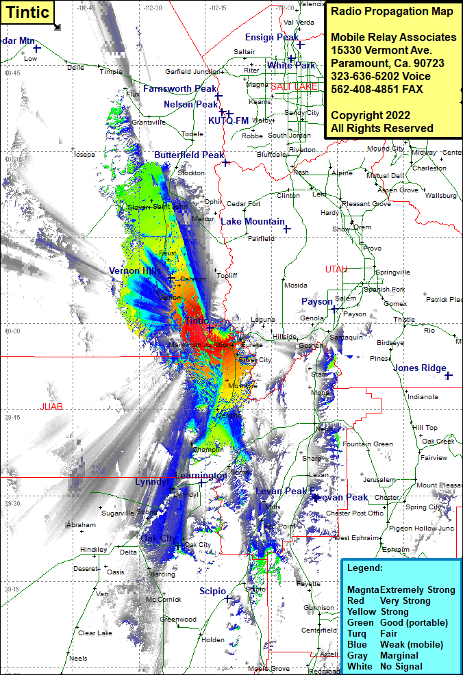 Tintic Coverage |
| Latitude: | 039 59 08.3N | 39.9856389 |
| Longitude: | 112 13 58.8W | -112.2330000 |
| Feet | Meters | |
| Ground Elevation: | 6688.0 | 2038.5 |
| HAAT: | 586.7 | 178.8 |
| City: | Lofgreen | |
| County: | Tooele | |
| State: | Utah |
This is not an MRA Owned Site. For space rental contact the site owner.
Do you own or manage this site? Click Here
Would you like to add a site to the Google Earth Map?? Click Here
Site Coverage: Coverage of Topliff, McIntyre, Silver City, Tintic Junction, Mammoth Junction, Eureka, Homansville, Dividend, Lant, Santaquin, Starr, Gypsum Mill, Levan, Mills, Red Point, Parley, Champlain, Lynndyl, Strong, Oak City, Sugarville, Lofgreen, Vernon, Pehson, Faust, Clover, Saint John, West Mercur, Ophir