Unitah
| Site Name: | Unitah | 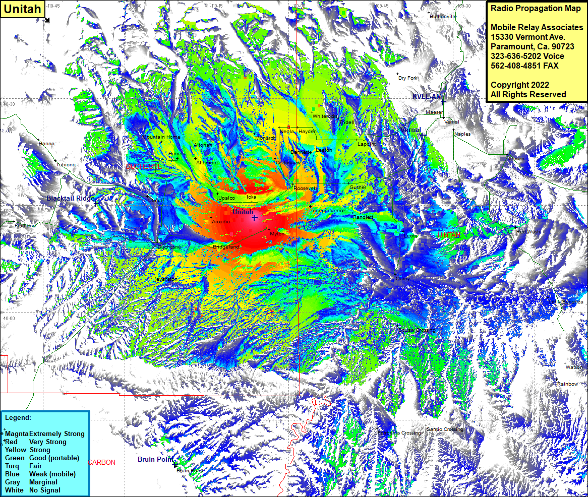 Unitah Coverage |
| Latitude: | 040 13 20.0N | 40.2222222 |
| Longitude: | 110 06 16.3W | -110.1045278 |
| Feet | Meters | |
| Ground Elevation: | 5643.0 | 1720.0 |
| HAAT: | 375.8 | 114.5 |
| City: | Myton | |
| County: | Duchesne | |
| State: | Utah |
This is not an MRA Owned Site. For space rental contact the site owner.
Do you own or manage this site? Click Here
Would you like to add a site to the Google Earth Map?? Click Here
Site Coverage: Coverage of Monarch, Cedarview, Ioka, Roosevelt, Independence, Fort Duchesne, Randlett, Gusher, Bennett, Leeton, Lapoint, Tridell, Whiterods, Hayden, Neola, Tridell, Naples, Dinosaur, Jensen, Mylon, Leota, Ouray, Squaw Crossing, Little Bonanza, Rainbow, Fairbanks Crossing, Bridgeland, Duchesne, Evanston, Arcadia, Upalco, Mount Emmons, Bluebell, Altamont, Boneta, Altonah, Mountain Home, Utahn