Vernon Hills
| Site Name: | Vernon Hills | 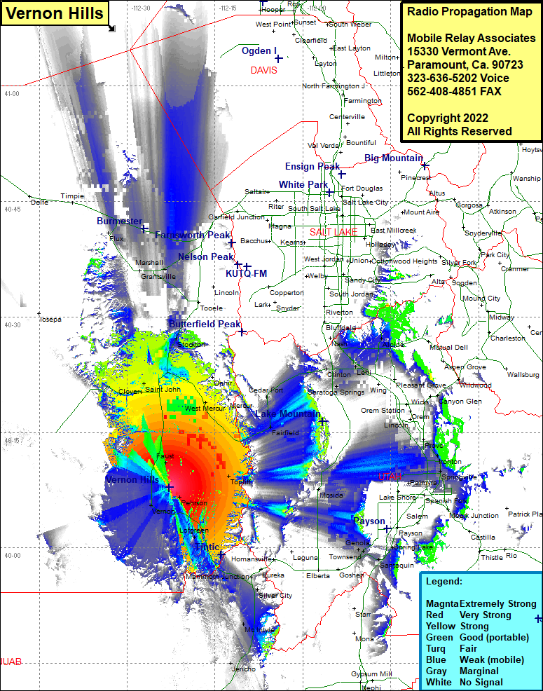 Vernon Hills Coverage |
| Latitude: | 040 07 50.9N | 40.1308056 |
| Longitude: | 112 22 49.8W | -112.3805000 |
| Feet | Meters | |
| Ground Elevation: | 5966.0 | 1818.4 |
| HAAT: | 511.2 | 155.8 |
| City: | Vernon | |
| County: | Tooele | |
| State: | Utah |
This is not an MRA Owned Site. For space rental contact the site owner.
Do you own or manage this site? Click Here
Would you like to add a site to the Google Earth Map?? Click Here
Site Coverage: Coverage of Vernon, Pehson, Faust, Clover, Saint John, West Mercur, Mercur, Fairfield, Cedar Fort, Clinton, Saratoga Springs, Lehi, Alpine, Mutual Dell, Aspen Grove, Wildwood, Canyon Glen, Nunns, Olmstead, Ironton, Springville, Mapleton, Palmyra, Lake Shore, Santaquin, Spring Lake, Townsend, Genola, Jerico, McIntyre, Dennis, Diamond, Silver City, Mammoth Junction, Lofgreen, Vernon, Faust, Clover, Saint John, Bauer, Stockton, Burmester, Grantsville, Flux, Marshall, Lago